
Posts From GIS Resources

PrecisionHawk Secures $75 Million to Foster Global Adoption of Commercial Drone Technology
Raleigh, NC – January 24, 2018 – PrecisionHawk, Inc. – a leading provider of drone technology for the enterprise – announced today it has raised a $75 million round of
GeoCalc SDK 7.4 Update Includes Support for New Projections and JSON Wrapper Classes for Calling to GeoCalc Cloud
Hallowell, Maine – January 23, 2018 – Blue Marble Geographics (bluemarblegeo.com) is pleased to announce the immediate availability of version 7.4 of the GeoCalc Software Development Kit (SDK). This powerful toolkit
DLR Spin-off EOMAP Launches an Online Portal for UNESCO Programme on Global Indicator of Water Quality
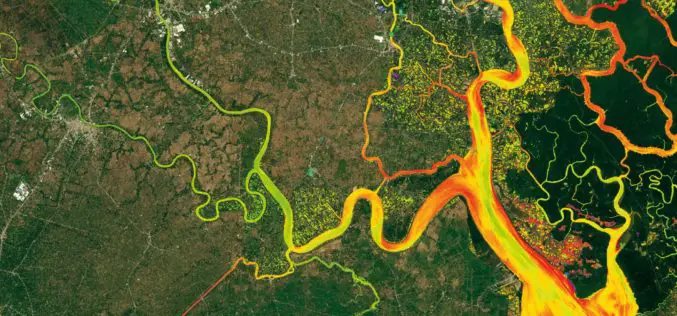
Worldwide mapping of water quality data for all inland and coastal waters is now possible for the first time thanks to satellite data. Using high-resolution remote sensing data, EOMAP has

SRA Mumbai to Use Drone to Map Slums
According to recent news reported by the Times of India – the Slum Rehabilitation Authority (SRA) will use a high-end drone for accurate mapping of slums across the metropolis. SRA chief executive officer Deepak Kapoor confirmed to

India: Government Added Nine New Names in Smart Cities
January 19, 2018 – New Delhi – Urban Development Minister Hardeep Singh Puri has announced the name of nine more smart cities, taking the total to 99. The mission of hundred

China Launches 2 Remote Sensing Satellites
JIUQUAN, 19 January (BelTA – Xinhua) – China launched two high-resolution optical remote sensing satellites into a preset orbit from the Jiuquan Satellite Launch Center in northwest China. The two
Esri Releases World’s First Complete Utility GIS Platform
New Utility Network Management Extension Combines Advanced System of Record with Location-Based Analytics Redlands, California – January 22, 2018 – Esri, the global leader in geographic information system (GIS) technology and spatial analytics,
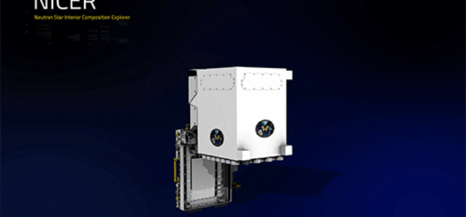
NASA Engineers Demonstrated X-ray Navigation in Space
According to recent news by NASA, a team of NASA engineers has demonstrated fully autonomous X-ray navigation in space — a capability that could revolutionize NASA’s ability in the future to

The University of Nairobi Hands the First KiboCUBE CubeSat over to JAXA Under UNOOSA-JAXA KiboCUBE Programme
January 19, 2018 – On January 16, 2018, at the JAXA Tsukuba Space Center, the team from the University of Nairobi handed over to JAXA their first KiboCUBE CubeSat, 1KUNS-PF
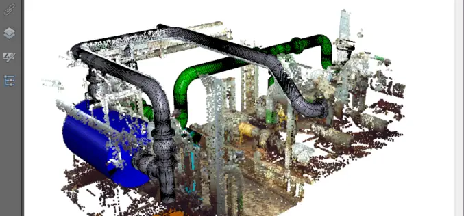
PDF3D’s V2.15 Brings New Tech, Panoramic 360 and Patented Point Cloud Simplification along with Highest Performing 3D PDF Conversion SDK
Popular 3D PDF conversion application brings a host of new features for CAD, scanning and photography, while putting DevOps first in the latest 3D PDF Development Toolkit PDF3D’s ReportGen V2.15
