
Posts From GIS Resources
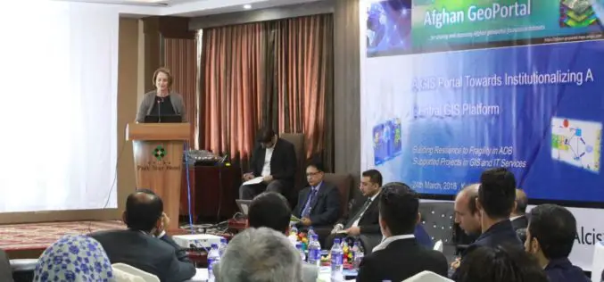
Asian Development Bank and the Govt of Afghanistan Launched “Afghan GeoPortal” to Improve Data Access, Sharing
KABUL, AFGHANISTAN (26 March 2018) — The Asian Development Bank (ADB) and the Government of Afghanistan launched the “Afghan GeoPortal” to help increase the Government of Afghanistan’s access to accurate
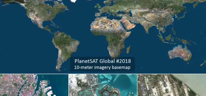
PlanetObserver Announces Release of PlanetSAT Global Imagery Basemap Version #2018
Clermont-Ferrand, France – 27 March 2018 – PlanetObserver, provider of geospatial data for civil and military solutions, announces the release of the most up-to-date global mosaic processed with recent and
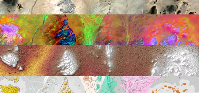
MDA to Provide RADARSAT-2 Information to Meet Critical and Complex Challenges for Land and Maritime Monitoring
March 26, 2018 – Richmond, BC – MDA, a Maxar Technologies company (formerly MacDonald, Dettwiler and Associates Ltd.), (NYSE: MAXR; TSX: MAXR), announced today it has recently signed multiple geospatial-related

India Fastest Growing Market for UAVs; To Touch $886 mn by 2021
New Delhi, Mar 26 (PTI) India is one of the fastest-growing markets for unmanned aerial vehicles (UAVs), and one of the top UAV importers for military purposes worldwide, says a

4th Farming by Satellite Prize Competition is Open!
Registration for the 4th Farming by Satellite Prize was officially opened at the conference “Agriculture: a new frontier for the European space policy” in the European Parliament on March 6.
Sentinel-1 and Sentinel-2 Missions Helping to Map Minerals in Africa
The traditional way of geological mapping is to record the location of rock outcrops, rock and fossil samples and structures observed in the field. The detailed description and sketches of
European GNSS Agency And Thales Launch EDG²E, A Dual-Frequency Multi-Constellation Receiver
According to recent news reported by the GPS World, together the European GNSS Agency (GSA) and Thales has launched a equipment for dual frequency Galileo, GPS and EGNOS project (EDG²E). The four-year-long

Global Mapper and LiDAR Module SDK v19.1 Now Available with New 3D Mesh Generation Capabilities
Hallowell, Maine – March 20, 2018 – Blue Marble Geographics (bluemarblegeo.com) is pleased to announce the immediate availability of version 19.1 of the Global Mapper Software Development Kit (SDK) along with
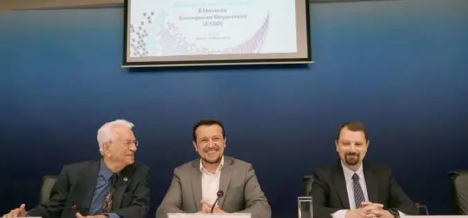
Greece Launches Its Own Space Agency – Hellenic Space Organization
According to recent news reported by the Neoskosmos.com, Almost a year and a half since the first announcement of its creation, the Hellenic Space Agency was officially launched on March 19, by Minister
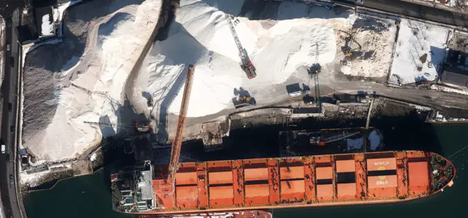
Col-East Inventories Salt Piles from the Air Each Winter in Preparation for Snowy Weather
NORTH ADAMS, Massachusetts, 20 March 2018 – Surveying and Mapping Consultants Inc. (SMC) of Braintree, Mass., has teamed with Col-East International Ltd. for the past 12 years to monitor inventories
