
Posts From GIS Resources
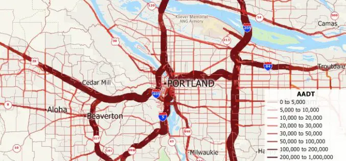
Free U.S. Traffic Count Data for Use with Maptitude 2018 Mapping Software
Newton, Massachusetts (USA) – Caliper is excited to announce the release of free USA traffic count data for Maptitude 2018 users. This latest map layer includes fields with total Annual Average Daily Traffic
GIS Resources Magazine (Issue 3 | September 2018): Geospatial Technologies to Preserve and Conserve Forests
GIS Resources Magazine (Issue 3 | September 2018): Geospatial Technologies to Preserve and Conserve Forests September 24, 2018 – GIS Resources, a leading global platform for latest and high-quality information source of the

Pix4D Accelerates Growth with A New Office in Madrid
A centre of innovation in the heart of Spain Lausanne, Switzerland: On November 1st 2018, Pix4D opens a new R&D office in Madrid. It is the company’s fifth office after

Thawing Arctic in Radar View – Permafrost Monitoring with Latest Radar Technology in German-Canadian Cooperation
September 17, 2018 – DLR German Aerospace Center, Germany – Scientists from the German Aerospace Center (Deutsches Zentrum fuer Luft- und Raumfahrt; DLR) Microwaves and Radar Institute are developing special
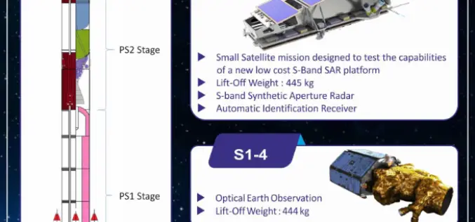
Indian Space Research Organisation (ISRO) Successfully Launches NovaSAR and S1-4 Satellite
Sriharikota, Andhra Pradesh, India – Sep 16, 2018 – The Polar Satellite Launch Vehicle (PSLV-C42) of Indian Space Research Organisation (ISRO) today (16 Sept 2018, Sunday) successfully launched two satellites — NovaSAR

Topcon Agriculture and Raven announce API Partnership
TURIN, Italy – September 6, 2018 – Topcon Agriculture and Raven Industries, both leaders in the precision agriculture market, announced today a licensing agreement for use of the Slingshot Application

Incident-Free UAS Operators Could Be an Accident Waiting to Happen, Warns Centrik
UAS operators who boast a record of zero safety incidents could be at major risk of disaster, according to David Hunkin, Head of UAS at operational management software provider Centrik.
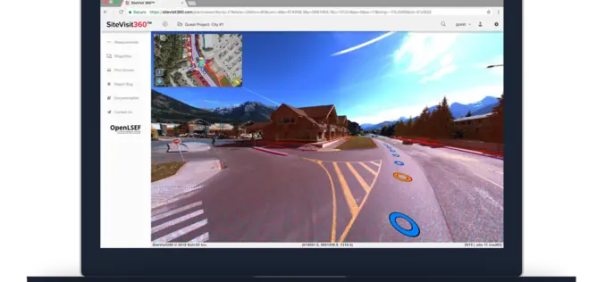
Solv3D Releases New Features Within SiteVisit360 Geospatial Collaboration Platform
CALGARY – September 6, 2018 – Solv3D, a leading provider of 3D processing, geospatial data visualization and collaboration tools announced that a number of new features were currently released within SiteVisit360™,
Topcon Introduces New Software for UAV Inspection Applications
LIVERMORE, Calif., U.S./ CAPELLE A/D IJSSEL, the Netherlands – August 30, 2018 – Topcon Positioning Group announces new software designed to facilitate data processing workflow for UAV (unmanned aerial vehicle) infrastructure
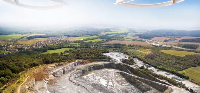
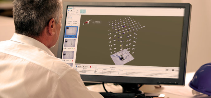
SimActive for Mining: Drones & Volume Calculation
SimActive Inc. is proud to announce new features to improve volumetric calculation. Correlator3D™ now has integrated tools for users to generate precise statistics on mining activities. Our clients often require

