
Posts From GIS Resources
USGIF Announces 2020 Achievement Award Winners
Outstanding organizations and individuals recognized for contributions to the geospatial intelligence community Herndon, Virginia (April, 21,2020)— The United States Geospatial Intelligence Foundation (USGIF) is pleased to announce the 2020 recipients

How to Choose an Aerospace Forging Supplier You Can Trust
Within the aerospace industry, a manufacturer is only as good as the part supplier it partners with. So when looking to find a part supplier or aerospace forging company,

PARSEC Business Accelerator Boosts EO Enterprises
Harnessing the power of Big EO Data requires efficient handling of the volume, velocity, variety, and veracity of multimodal EO data, such as the Copernicus Sentinels. SMEs entering the EO market require expensive experts top-skilled in IT and remote sensing alike, which distracts precious resources from the core business. These barriers make it difficult for SMEs gaining ground in the market.

Effects of Technology and Digitalization to Your Business
There are numerous aspects of your business operations that technology and digitalization can impact. Some of the positive effects of embracing technology in your business include the automation and simplification of tasks, improved communication, sharing and distribution of information between stakeholders, increased productivity and potential to work remotely. Two areas that are particularly affected by technology is the marketing and security of your business.
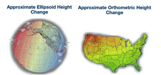
Trimble Geospatial Webinar on NGS 2022 Spatial Reference Framework Modernization
Please join the Trimble Business Center (TBC) team and Dr. Dru Smith, the National Spatial Reference System (NSRS) Modernization Manager from the National Geodetic Survey (NGS), as we discuss NGS’ 2022 datum modernization efforts.
Pix4D Announces A New Generation of Tools for Photogrammetry, Drone Mapping and Analytics
Lausanne, Switzerland, March 31st, 2020 – Photogrammetry leader Pix4D is announcing today the commercial release of next-generation software addressing the modern-day professional challenges. Developed in close collaboration with customers and
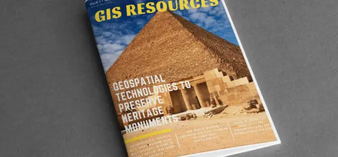
GIS Resources Magazine (Issue 1 | March 2020): Geospatial Technologies to Preserve Heritage Monuments
GIS Resources is pleased to announce the release of its 1st edition (March 2020) of the print and digital magazine. The edition titled “Geospatial Technologies to Preserve Heritage Monuments” focuses

Bentley Systems Announces the Acquisition of GroupBC, UK Leader in Cloud Services for Construction Information Management
Advancing Project and Asset Common Data Environments (CDEs) through Digital Twins LONDON, UK – March 11, 2020 – Bentley Systems, Incorporated, a leading global provider of comprehensive software and digital

Volumetric Calculations for Stormwater Retention Ponds, Basins & Quarries
Integration with CAD Enhanced AARSCHOT, Belgium, 2 March 2020 – Virtual Surveyor has released Version 7.1 of its popular drone surveying software, introducing functionality to efficiently calculate volumetrics in quarries,

Aspectum Releases A Smart Map of Besiktas Shipyard for Better Maritime Business Management
Aspectum, a cloud service for location data analytics, presents its latest interactive map of Besiktas Shipyard. This map serves as an example of shipyard management. Just in a few clicks,
