
Posts From GIS Resources
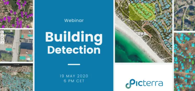
Webinar: How to Detect Buildings with State-of-the-art Technology of Picterra
Building detection is a very common application of Picterra. The most popular use cases include counting different types of buildings, differentiating them from ongoing constructions, and finding various patterns.

Touch GIS App Introduces Digital Clinometer Tool for Geologist
Touch GIS has introduced a digital clinometer tool to assist field geologist in recording strike & dip readings. Version 1.3 of the app also features a new ‘Attitude’ attribute type,
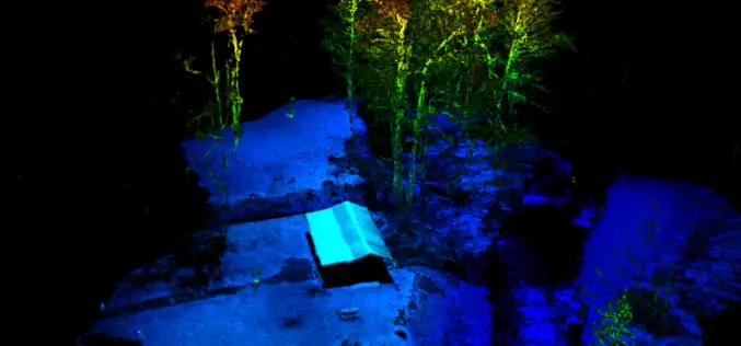
RedTail LiDAR Systems Supports Wounded Veterans Through Stream Restoration
The RedTail LiDAR System’s RTL-400 was used to aid in the bank restoration efforts that saved the cabin, improved stream access for disabled anglers, and more!
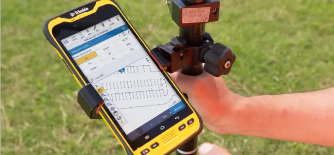
Trimble Geospatial Announces Release of New Version of Trimble Access
New Version of Trimble Access Enables Broader Accessibility to Android OS for Surveyors Trimble TDC600 Android Device and Trimble Access 2020 Software Provide More Flexibility for a Diverse, Mobile Workforce. SUNNYVALE, Calif.,

Avineon Completes Acquisition of Two Springs Consulting
McLean, Virginia – May 5, 2020 – Anand Subramani, President of Commercial Systems at Avineon®, is pleased to announce the acquisition of Two Springs Consulting LLC (Two Springs). As a
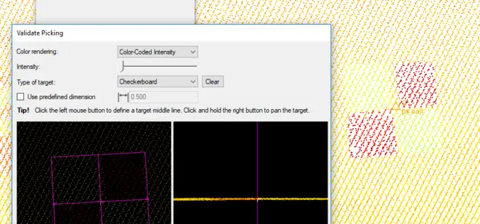
Trimble Business Center (TBC) v5.3 is Now Available, So What’s New in TBC v5.30?
Trimble has announced the release of version 5.30 of Trimble Business Center (TBC v5.3) office software that enables surveyors and geospatial professionals to simplify the creation of cadastral, GIS, infrastructure inspection and tunnelling deliverables.

Centrik and Flock Sign Strategic Alliance to Deliver Data-Driven Reduced Risk Operations for The Drone Sector
Operational management system supplier Centrik and specialist drone and eVTOL insurance provider Flock have formed a strategic alliance to raise safety standards and reduce risk in commercial drone operations.
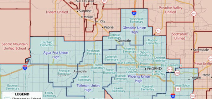
Maptitude 2020 U.S. School Districts Data Available as KML, GeoJSON, Shapefile
The Maptitude 2020 U.S. School Districts Data is available and includes three nationwide map layers of elementary, secondary, and unified school districts.
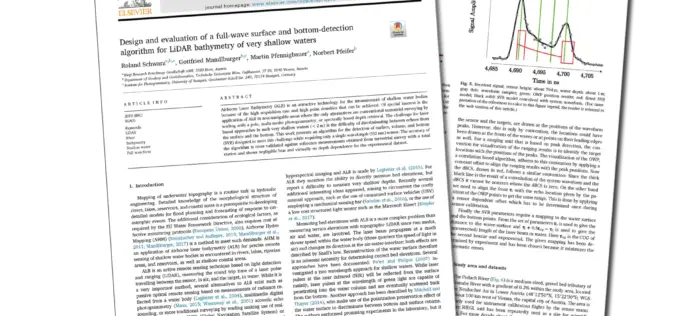
Joint Scientific Article on LiDAR for Bathymetry of Very Shallow Waters, under the Leadership of RIEGL, wins ISPRS Best Paper of 2019!
Every year the ISPRS (International Society of Photogrammetry and Remote Sensing) chooses the Best Paper of the Year from the wide range of publications in the ISPRS Journal of Photogrammetry and Remote Sensing.
USGIF Announces 2020 Achievement Award Winners
Outstanding organizations and individuals recognized for contributions to the geospatial intelligence community Herndon, Virginia (April, 21,2020)— The United States Geospatial Intelligence Foundation (USGIF) is pleased to announce the 2020 recipients
