
Posts From GIS Resources

Publishing a Map Service with ArcGIS 10.1
This video is useful for anyone with interest in this topic.
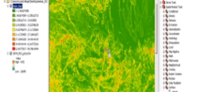
Analysis of Digital Elevation Model in ArcMAP
This is a how-to to demonstrate the creation of first and second order derivatives in ArcMAP using SRTM 3 data.
PR: Esri Announces Climate Resilience App Challenge 2014
Esri, the world leader in mapping technology, unveiled The Esri Climate Resilience App Challenge 2014, calling all developers to create an app using the Esri ArcGIS Platform to help communities, see,
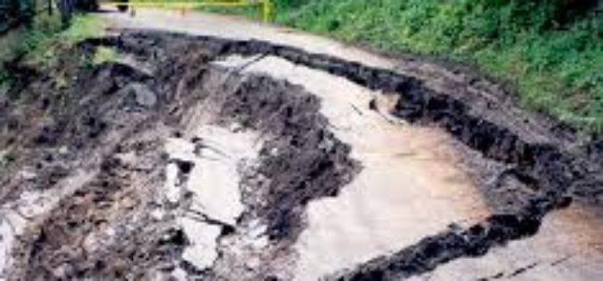
Microwave Radar Monitors Sliding Slopes
Geodesists from TU Darmstadt, Germany, research in the Alps The “Steinlehnen” slope in Northern Tyrol (Austria) started to move in 2003. Rockfalls threatened people, streets and buildings. Meanwhile, peace has
South Delhi Municipal Corporation to Use Geo-spatial Technologies for Waste Management
In recent news, South Delhi Municipal Corporation (SDMC) is planning to use geo-spatial technology for monitoring and implementation of waste management in municipal corporation area. The sanitation action plan includes GPS-tracked garbage

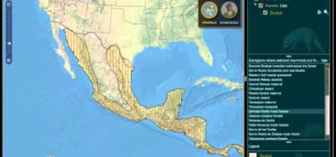
Crowdsourcing the Search for Malaysia Flight 370 – Join The Search
As the mystery of what happened to the 239 people on board Malaysia flight 370 deepens, a Colorado satellite imaging company is launching an effort to crowdsource the search, asking

Indoor Google Maps for 75 Popular Indoor Venues
In a recent post in Google India blog, Indoor Google Maps comes up with 75 popular indoor venues across 22 cities in India. Google India has adopted My Location technology to
Qatar University Begins Digital Archiving
In a recent news by Gulf Times, Remote Sensing and Geographic Information Systems (GIS) Unit in the Environmental Studies Centre (ESC) at Qatar University has initiated the course of action to digitally

Looking Down from 600 km Above the Earth’s Surface with HD Video
Looking Down from 600 km Above the Earth’s Surface with HD Video – It will be possible to see the world is real time…By Skybox Imaging
PR: Topcon TopNETlive fastest growing GNSS network service in North America
LIVERMORE, Calif., USA/ CAPELLE A/D IJSSEL, The Netherlands – March 5, 2014 – Topcon Positioning Group announces the expansion of its TopNETlive network service into nineteen states and five Canadian provinces, making

