
Posts From GIS Resources
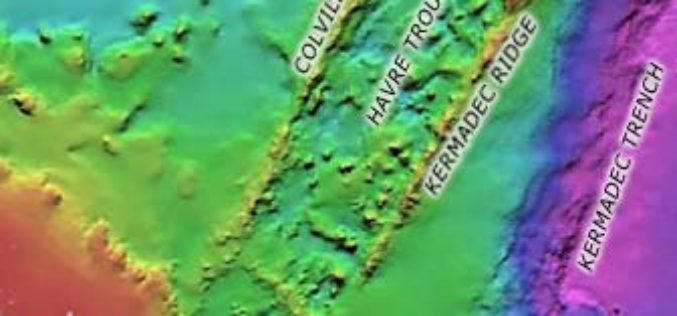
3D Imaging Revealed Submerged Ridge East of Auckland
In news, 3D imaging has revealed remarkable submerged mountainous Colville Ridge features in east of Auckland. Three-dimensional imaging shows mountainous ridge covered with jagged cones and with valleys that lie about 2km
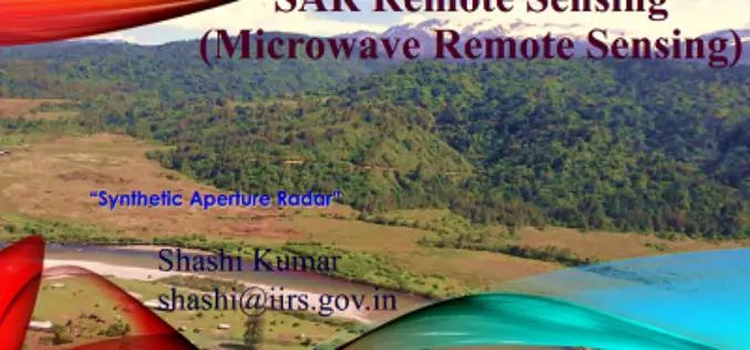
PPT on SAR Remote Sensing and Its Introduction
The PPT on SAR Remote Sensing and Its Introduction, provide a complete introduction about Synthetic Aperture Radar. Compiled by: Shashi Kumar, IIRS, Dehradun

Phd Position (Promovendus) Mapping Informal Settlements at ITC Netherlands
The Faculty of Geo-Information Science and Earth Observation (ITC) delivers international postgraduate education, research and project services in the field of geo-information science and Earth observation using remote sensing and

The Spectral Reflectance Responses of Water with Different Levels of Suspended Sediment in The Presence of Algae
The Spectral Reflectance Responses of Water with Different Levels of Suspended Sediment in The Presence of Algae Abstract: Examining and measuring levels of suspended sediments of water column is a common application
Monitoring Himalayan Cryosphere Using Remote Sensing Techniques
Monitoring Himalayan Cryosphere using Remote Sensing Techniques Abstract: In the Himalayas, large area is covered by glaciers, seasonal snow and changes in its extent can influence availability of water in the Himalayan
ArcGIS Desktop Version 9.2 ArcInfo™ Functional Level (Includes ArcView® and ArcEditor™ Functionality) Tutorial.
The tutorial was created by Stephan Pollard, M.A. Geography (University of Arkansas, 1997) and Ph.D.. Environmental Dynamics (University of Arkansas, 2006) and Sohayla Hamon, M.A. Geography (University of Arkansas, 2002). ArcGIS Desktop
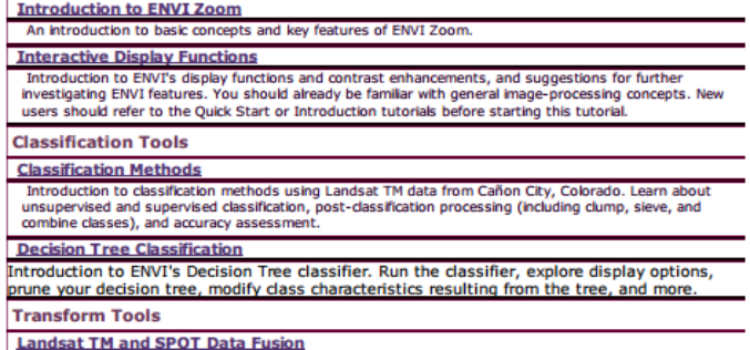
Tutorials for ENVI by Category
This PDF contains external links to Tutorials for ENVI by Category
Phd Position (Promovendus) Spatio-Temporal Disease Mapping And Modelling at ITC Netherlands
The Faculty of Geo-Information Science and Earth Observation (ITC) delivers international postgraduate education, research and project services in the field of geo-information science and Earth observation using remote sensing and
GPS Tracking to Combat Domestic Violence
REPEAT domestic violence offenders could be strapped with GPS tracking bracelets and forced to foot the bill under a NSW government proposal. NSW Community Services and Family Minister Pru Goward
PR: 3D Vegetation Library Delivers Advanced Models for Urban Design and GIS Professionals
Esri and E-on Software Provide 3D Toolset for Planning, Geodesign, and Other Industries Redlands, California—Esri, the leading provider of GIS solutions, and e-on software, the leader in 3D immersive nature
