
Posts From GIS Resources
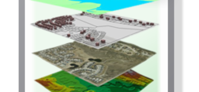
Understanding Shapefile (.shp) File Format
Shapefile is a vector data format for storing geographical data and associated attribute information. It is developed and regulated by Esri as open specification for data interoperability among Esri and other GIS software products. Shapefile

Europe Lofts First Copernicus Environmental Satellite
3 April 2014-The ability of European citizens, policymakers and service providers to access key environmental data on a routine basis will take a major step forward following the launch today

UNDP to Support Saudi in Geospatial Capacity Building
In recent news, the UN Development Program (UNDP) have signed a capacity development project with the General Commission for Survey (GCS) with the main objective of developing national capacities in

India’s PSLV-C24 Lifted off Sucessfully IRNSS-1B Spacecraft
The PSLV-C24 lifted off at 17:14 hrs (IST) on board with IRNSS-1B spacecraft. IRNSS-1B is the second satellite of India’s national programme Indian Regional Navigation Satellite System (IRNSS). IRNSS system will
E-Tender: Establishment of GIS Based Pipeline Asset Management
Oil India Limited (OIL), a Government of India Enterprise and premier oil company in India is engaged in exploration, production and transportation of crude oil & natural gas having its

Blue Marble Releases GeoCalc 7.0 with EPSG “Area of Use” Polygon Data
Hallowell, Maine – April 2, 2014 Blue Marble Geographics (bluemarblegeo.com) is pleased to announce the release of the GeoCalc 7.0 software development kit (SDK). This release features new functionality to display
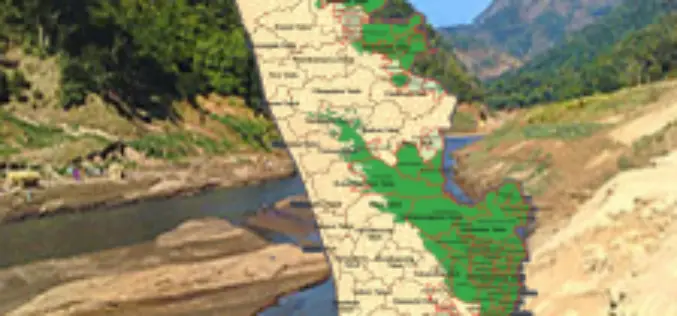
Callous Approach of KSREC in Mapping Ecologically Sensitive Areas
In recent news, the maps prepared by the Kerala State Remote Sensing and Environment Centre (KSREC) of Ecologically Sensitive Areas (ESAs) in the state, have major discrepancies including showcasing of

Robotic Total Station to Collect Crash Scene Evidence
According to recent news, Dodge County, USA has obtained Leica Robotic Total Station to collect evidence faster at crash scenes. Investigation of traffic collision is quite a challenging task for

Ordnance Survey launches OS Ride app with Chris Boardman MBE
With less than three months to go before The Grand Départ in Yorkshire, Ordnance Survey has teamed up with cycling legend Chris Boardman to launch a free cycling app to help

Sentinel Data Free and Open for Pre-registration
In anticipation of the launch for Sentinel-1A, the European Space Agency is pleased to announce the possibility for users to pre-register for online access to Sentinel data. The free, full

