
Posts From GIS Resources

Vietnam to Use Remote Sensing in Agriculture
In recent news, Vietnam is gearing up to use Remote Sensing to boost its agricultural production. In a conference last week Le Quoc Doanh, Deputy Minister of Agriculture and Rural
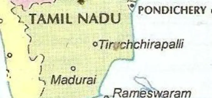
Tamil Nadu Integrates GIS Mapping to Check on School Dropouts
Tamil Nadu would be the first state in the country to integrate Geographical Information System (GIS) mapping with the education management information system to check on school drop outs, IT
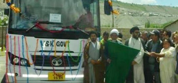
J&K Govt: Must Have GPS in all Commercial Vehicles
Jammu and Kashmir government is contemplating to install Global Positioning System (GPS) in all commercial vehicles to check violations like overloading, over-speeding and flouting of route permits. “All types of commercial

GPS to be Installed in Apple-Carrying Vehicles: HP Govt
The Himachal Pradesh government will install Global Positioning System in all apple-carrying vehicles to monitor their movements and check theft cases, a minister said here on Saturday. Horticulture Minister Vidya
Introducing Google Maps Coordinate
Google Coordinate will now be included with every Maps Engine Pro subscription ($5/user/month). Google Maps Coordinate, is the mobile and web app that lets teams assign jobs and share their

University of Glasgow Offering MSc/PgCert/PgDip Course in Geospatial and Mapping Sciences
Founded in 1451, Glasgow is the fourth-oldest university in the English-speaking world. Over the last five centuries and more, we’ve constantly worked to push the boundaries of what’s possible. We’ve fostered

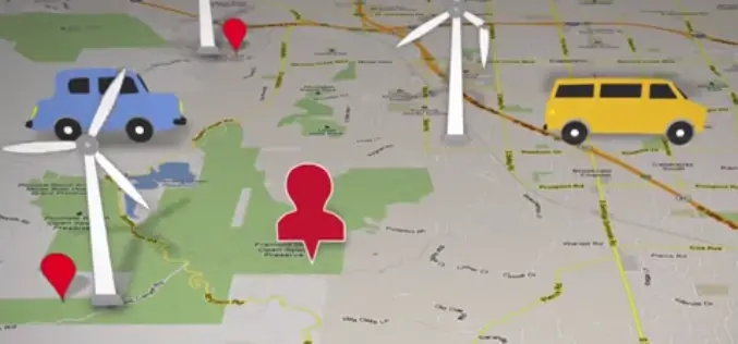
Meghalaya Preparing Wind Energy Density Maps
Power-starved Meghalaya is preparing “wind energy density maps” to identify regions in the mountainous state where wind energy could be tapped to meet the power requirement, an official said Thursday.
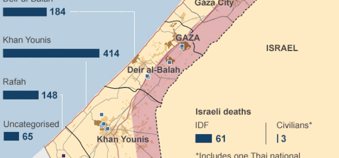
Mapping the Human Cost in Gaza
In recent news by BBC, more than 1,400 Palestinians have been killed and 450,000 have been forced to leave their homes since Israel launched Operation Protective Edge in Gaza on

West Bengal to Use GIS: Keep Track of Rural Development
In recent new, The West Bengal state government planning to setup a new geographic information system (GIS) technology based computer based system to keep track of progress of rural activities in

