
Posts From GIS Resources
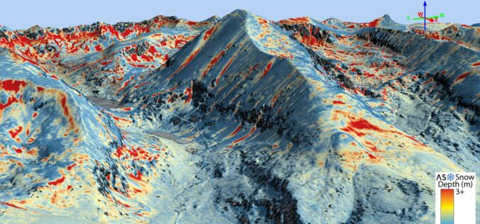
Airborne Snow Observatories, Inc. Takes Delivery of the All-New Cutting-Edge RIEGL VQ-1560 II-S LiDAR System
Airborne Snow Observatories, Inc. has just taken delivery of one of the first in North America cutting-edge RIEGL VQ-1560 II-S airborne laser scanners, just as the ASO program at NASA

How GIS Can Impact Major Console Releases?
The video game industry is worth more than any other entertainment history. It is worth more than television, more than the film industry and more than the music industry. People

NIT Karnataka is Offering Free Course on Machine and Deep Learning for Remote Sensing Applications
NIT Karnataka is Offering is offering two weeks online summer school on Machine and Deep Learning for Remote Sensing Applications.
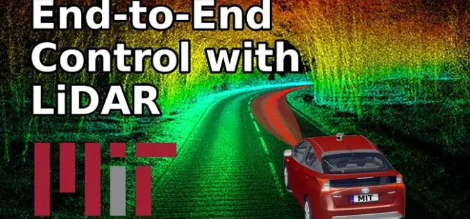
How MIT using LiDAR and ML for More Efficient Self-driving Car?
A LiDAR (Light Detection and Ranging) system beams light out and then precisely monitors the timing of reflections to map and track objects within its detection range. A LiDAR instrument principally
SIIS and UP42 Agreement Makes KOMPSAT Satellite Imagery Available on the Marketplace
SI Imaging Services (SIIS) of Daejeon, South Korea and UP42, have signed an agreement to make imagery from the KOMPSAT satellites available on the UP42 marketplace and developer platform. The

USGS Developed High-Resolution Imagery of Coastal Wetlands to Identify Vulnerable Marshes across the US
Scientist have used a combination of remote sensing and satellite technologies to identify vulnerable marshes across the US.

Intermap and TATA Communications Signed Agreement for 5G Network
Initially Intermap will support TATA’s expansion of its 5G network in selected Indian cities.

Animal Dynamics Adopts Centrik – ‘The Management System of Choice for UAS Operators
Animal Dynamics, the bio-inspired engineering company, has adopted Centrik to manage all facets of its increasingly complex operation as the business continues to grow. Animal Dynamics occupies a unique place
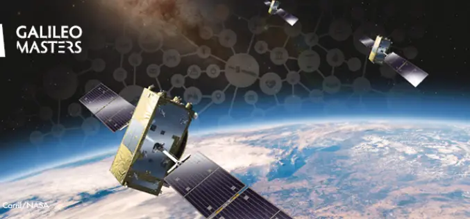
Galileo Masters Competition Inviting Cutting-Edge Solutions Using Satellite Navigation Data
The Galileo Masters is the global innovation competition that encourages and supports technological advancements, driven by Satellite Navigation data into successful society-oriented applications. The fundamental mission of this competition is
Unearth Joins Trimble’s GIS Partner Program to Provide Greater GNSS Accuracy and Streamlined Data Collection for Users in Municipal Applications
Integration with Trimble Real-Time GNSS Increases Data Accuracy for Map-Based Project Management SUNNYVALE, Calif., May 20, 2021—Trimble (NASDAQ: TRMB) announced today that Unearth Technologies, a provider of map-based project tools

