
Posts From GIS Resources
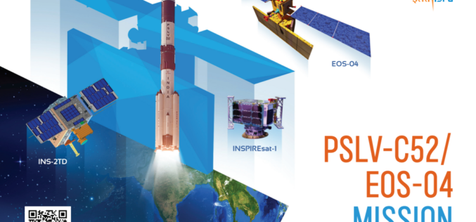
ISRO’s First Launch of the Year 2022, PSLV-C52 successfully launches EOS-04 and other 2 Satellites
On Valentine’s day, ISRO has given a gift to the nation with the successful launch of the Polar Satellite Launch Vehicle PSLV- C52 successfully launched EOS-04 Satellite from the first
RMSI Develops Award-Winning Land Record Information Management System for the Department of Land Management and Archive (DOLMA), Nepal
RMSI, a global leader in geospatial and engineering solutions, was commissioned by The Department of Land Management and Archive (DOLMA), Nepal, to deliver a web-based solution, Land Record Information Management
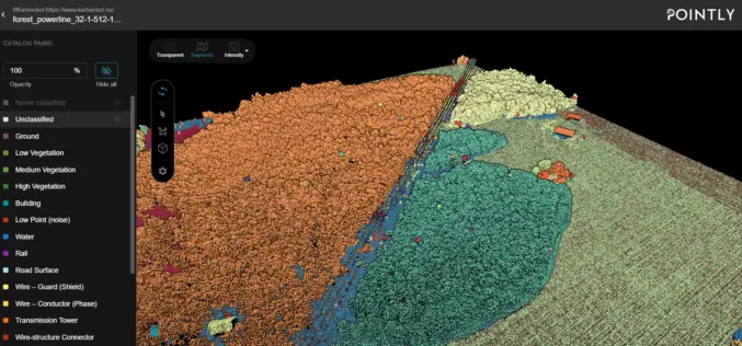
Automated Point Cloud Analysis for Forestry Mapping
Pointly has developed AI solution, that takes point clouds as input and outputs a shapefile with the location of tress for forestry mapping.
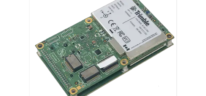
Applanix Introduces Next-Generation OEM Solution for Mobile Mapping Applications Using GNSS-Inertial Technology
Hardware and Software Platform Provides Unparalleled Accuracy and Performance for Systems Integrators Applanix, a Trimble Company (NASDAQ: TRMB), announced today the Trimble® AP+ Land GNSS-inertial OEM solution for accurate and

Master Basic Math Skills With the Help of Online Math Tutors
Increase Your Confidence With the Help of Online Math Tutors There’s no getting around it—math is a difficult subject for many people. Those who never had the chance to master

Take Your Next Business Presentation Virtual
Virtual business meetings have been on the rise with many people now working from home and away from their usual office settings. Business people are now meeting with their clients

New Company Name and Vision Grounded in Market Growth and Planned Expansion
Critigen, an international leader in spatial technology, today announced it has rebranded as Locana, communicating an expanded vision of location intelligence as well as accelerated plans for product and service offerings.
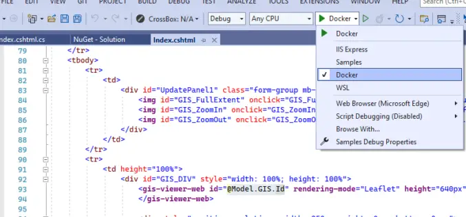
TatukGIS Releases SDK for ASP.NET Core
TatukGIS has released the ASP.NET Core edition of its GIS Developer Kernel (DK) product for developing custom web GIS applications for Windows, Linux, and macOS servers (including Docker). Support includes application development

What You Need To Know Before Buying a SEO Service
So, you want to hire an SEO service? That’s great! But before you do, it’s important you know what they do and how much their services will cost. Finding an affordable

Remote Sensing and GIS for Sustainable Forest Management
The data needed for forest management include wood procurement potential, forest cover, growing stock volume, and biomass carbon balance.
