
Posts From GIS Resources

Avenza MAPublisher Now Features ArcGIS Online Integration within Adobe Illustrator
Connect to ArcGIS Online within Adobe Illustrator to import and work with data layers Toronto, ON, January 4, 2017 – Avenza Systems Inc., producers of the Avenza Maps app for
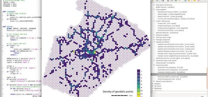
GRASS GIS 7.2.0 Released
After almost two years of development the new stable major release GRASS GIS 7.2.0 is available. It provides more than 1950 stability fixes and manual improvements compared to the former

Project X Labs Makes Location Intelligence Intuitive With Geodash 3.2
Fully Compatible With Microstrategy 10.6 and Now Bundled With Intellisite TORONTO, ON–(Marketwired – January 03, 2017) – Project X Labs Ltd. is pleased to present GeoDash™ 3.2 and GeoDash™ 3.2M
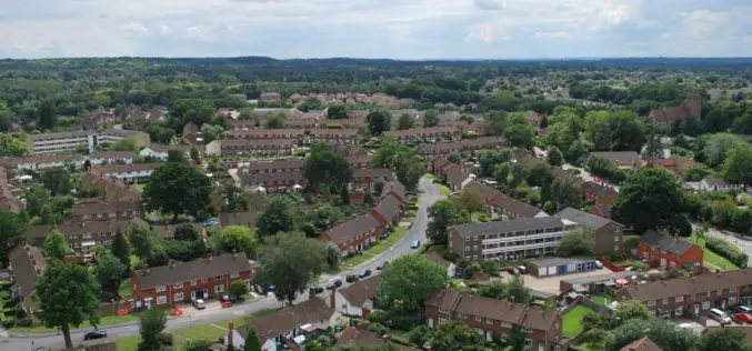
Bracknell Forest Homes Drives More Benefits From GIS
Bracknell Forest Homes is using a GIS for digital transformation and to create new streamlined processes. The GIS helps the business from reducing under-occupancy rates to helping find new development opportunities, and it now
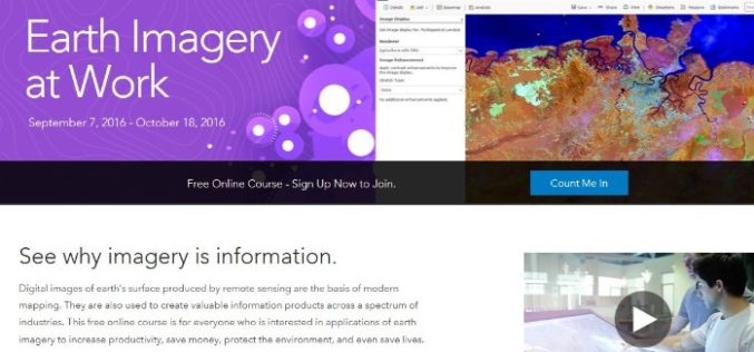
Register Now For Esri MOOC Program: Earth Imagery at Work
Earth Imagery at Work February 1, 2017 – March 14, 2017 Digital images of earth’s surface produced by remote sensing are the basis of modern mapping. They are also used to
ESA Sentinel App Season Update!
A new update of the ESA Sentinel App is coming up! The latest changes have brought us the acquisition plans and swath animations for Sentinel-1A, Sentinel-1B and Sentinel-2A, a powerful

Maharashtra Forest Dept Gets New GIS Based Command Centre to Monitor Forest Reserve
Maharashtra – According to recent news by The Hindustan Times, in a first for the country, the Maharashtra State Forest Department will use real-time satellite images of all forested areas
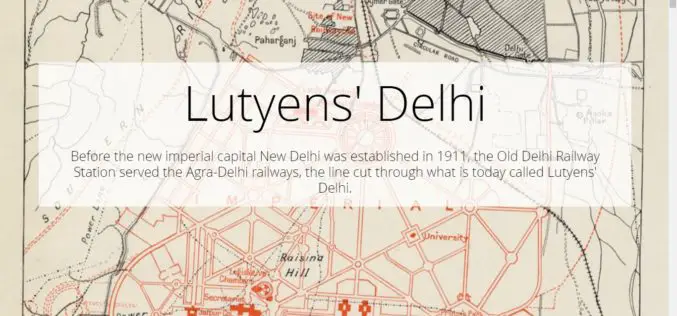
Lutyens’ Delhi
Contributed By:- Lutyens’ Delhi is an area in New Delhi, India, named after the British architect Edwin Lutyens (1869–1944), who was responsible for much of the architectural design and building
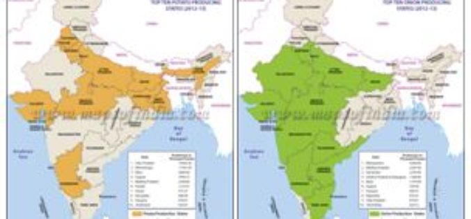
Agriculture Ministry Plans to Utilize Remote Sensing to Map Potato & Onion Cultivation Area
NEW DELHI: According to recent news by The Economic Times, the agriculture ministry is planning to use remote sensing technology to map the area under potato and onion cultivation for
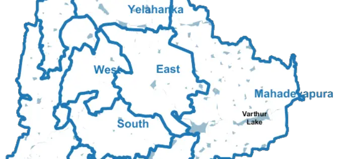
Bengaluru City to Have Geospatial Enabled Property Tax Information System
According to recent news by the Time of India, the online platform for property tax management has been set up by Bruhat Bengaluru Mahanagara Palike (BBMP) in association with the Indian

