
Posts From GIS Resources
Esri Releases Advanced Analytics to Increase Retail Sales
Indoor Spatial Analysis of Consumer Behaviors Boosts Profits and Increases Customer Satisfaction January 17, 2017 – Redlands, California—Esri, the global leader in spatial analytics technology, today announced a partnership with GISinc

JNARDDC and MRSAC are Developing Bauxite Mining App
Nagpur-India: According to recent news by The Times of India, the Jawaharlal Nehru Aluminium Research Development and Design Centre (JNARDDC), Nagpur, in collaboration with the Maharashtra Remote Sensing Application Centre (MRSAC),

PCI Geomatics Marks Milestone in Cloud-Based Image Processing
MARKHAM, Ontario, Canada, January 17, 2017 — PCI Geomatics, a world-leading developer of remote sensing and photogrammetric software and systems, announced today that it is six years since it began
DataMapper Releases Triangular Greenness Index App
DataMapper has recently introduced Triangular Greenness Index app in the DataMapper’s Algorithm Marketplace. Triangular Greenness Index is developed by Exogenesis, an advanced GIS and remote sensing company, the app is a highly

SimActive Used for Coastal Erosion Assessment with UAVs
SimActive Inc., a world-leading developer of photogrammetry software, is pleased to announce that Universiti Teknologi Malaysia (UTM) has chosen Correlator3D™ for its unmanned aerial vehicle (UAV) research. “We assessed photogrammetry
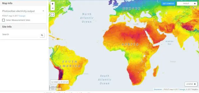
New World Bank Tool Helps Map Solar Potential
ABU DHABI, January 17 — The World Bank, in partnership with the International Solar Alliance (ISA), launched the Global Solar Atlas, a free, web-based tool to help investors and policymakers identify potential
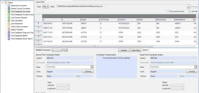
Geographic Calculator 2016 SP2 Release Coincides with the Unveiling of the New Cloud-Based Online GeoCalc Geodetic Registry
Blue Marble Geographics is pleased to announce the immediate availability of Geographic Calculator 2016 Service Pack 2 (SP2). This release includes numerous improvements to the usability of the software; updates

OGC Seeks Public Comment on OGC WaterML 2 – Part 3, Surface Hydrology Features Conceptual Model
The membership of the Open Geospatial Consortium (OGC®) seeks public comment on its WaterML 2 – Part 3, Surface Hydrology Features Conceptual Model. The OGC WaterML 2 – Part 3,
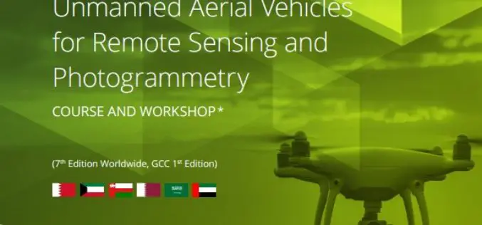
ICBA Workshop on Unmanned Aerial Vehicles for Remote Sensing and Photogrammetry
Unmanned Aerial Vehicles for Remote Sensing and Photogrammetry Monday, March 20, 2017 – Wednesday, March 29, 2017 International Center for Biosaline Agriculture (ICBA) is an international, non-profit agricultural research center
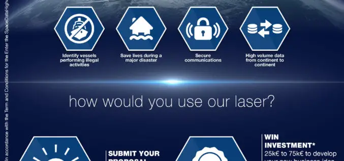
Airbus Launches “Enter the SpaceDataHighway” Challenge
• Aims to foster innovation for its brand-new laser-based space communication system. • Winner will be awarded €75,000 investment and will get support of Airbus BizLab. 12 January 2017 – Transmitting large

