Some rapidly growing Asian cities may see increases of up to 36% in the population at risk of extreme river and surface water flooding by 2020, according to recent study undertaken by JBA Risk Management.
The Asia Pacific region (includes 26 countries), has over half of the world’s total population. And several countries host many of the world’s most populous cities and rapidly emerging insurance markets.
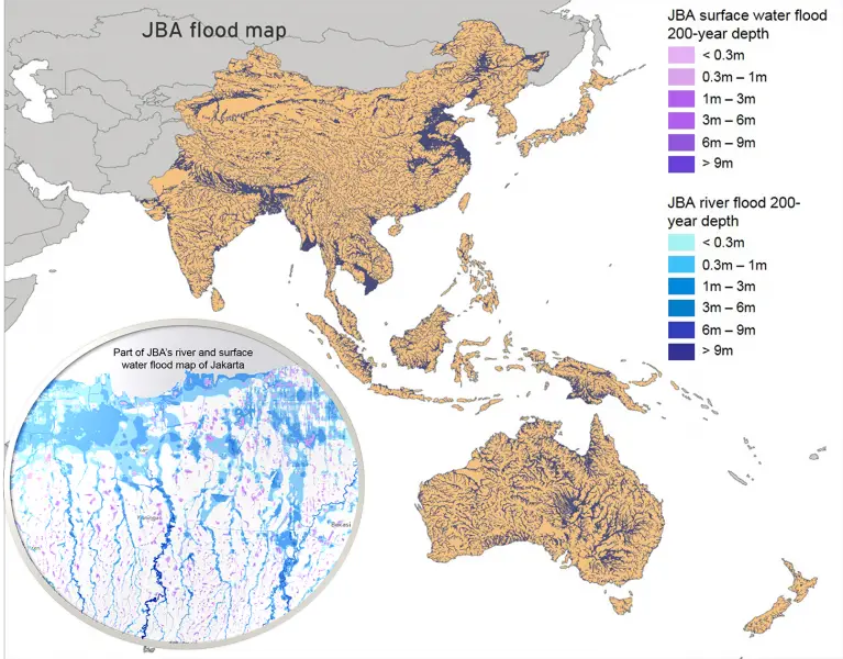
Given that several of these cities lie next to major river systems, prone to extreme flood risk, JBA Risk Management assessed some of the potential broad scale impacts future flooding could pose in the region.
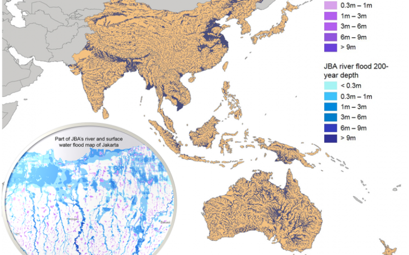
Credit: JBA Risk Management
The study initially focused on four principal Asian cities; Jakarta, Bangkok, Manila, and Singapore. Using a Geographical Information System (GIS) JBA’s 30m resolution global flood maps (GFMTM) were compared to gridded population density projections to estimate the exposed population in both 2010 and 2020.
The findings highlight that significant population increases are projected for all four Asian cities and that the number of people exposed to extreme river and surface water flooding (classified using the 1/200 year maps) could increase by over 30% in the 10 year period from 2010 to 2020.
When compared to the JBA river flood extent for a 1/200 year return period, Bangkok and Jakarta show population exposures of 5.3 million and 5.2 million. This would represent a 36% and 33% rise from 2010 levels respectively. Manila could see increases of around 27%, whilst Singapore was the lowest at 17%. Similar increases were noted for surface water as well.
The study made use of UN projected population density data from the Worldpop project (www.worldpop.org), an open initiative aimed at providing spatial demographic datasets at 100m resolution for multiple years including 2010 and 2020.