SuperGIS Network Analyst is one of the six extensions of SuperGIS Desktop, which is a powerful tool that enables users to conduct network analysis for finding the best route or the most suitable site. Network analysis can be applied in various fields, such as transportation planning, tourist route planning, utility construction, site selection of convenience stores, etc.
With many newly added features and flexible settings, the brand new SuperGIS Network Analyst 10 will be unveiled in this September. In this upgraded version, users can input different point layers as the starting and finishing point respectively and then calculate the Origin-Destination matrix (O-D matrix). By establishing an O-D matrix, users can acquire the distance between different types of objects. For example, a transportation planning expert can therefore calculate the moving cost between all dwelling places and bus stops in a certain area to estimate the average moving cost. And after knowing such information, the expert can further examine whether the current distribution of bus stops is optimal.
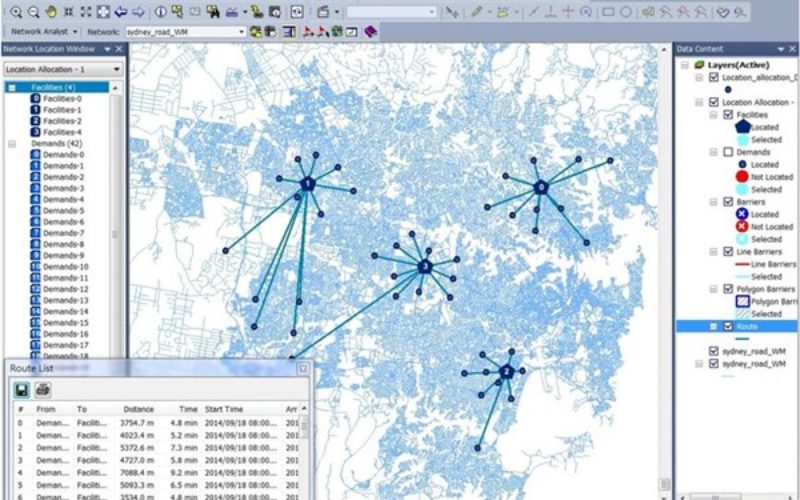
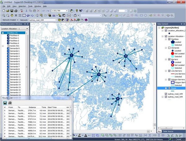
Other than the O-D matrix, the Network Analyst 10 also adds many new settings to the current superior route analysis. Now, users can decide whether to reorder the stops or to reorder them while keeping the starting and finishing point. Or, users may also choose the setting that allows reordering the stops and will go back to the starting point eventually. With these more flexible settings for superior route analysis, users can easily find the shortest path for different given conditions. In summary, the latest Network Analyst 10 will help users to solve more complex network planning problems in a more efficient and effective way.
Try SuperGIS Desktop right now:
http://www.supergeotek.com/download_6_desktop.aspx
Or contact us for the details of Network Analyst 10:
staff@supergeo.com.tw