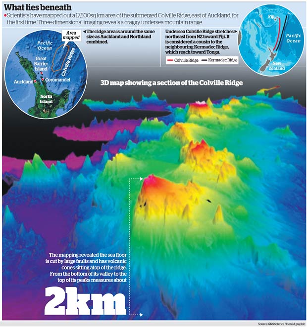
 In news, 3D imaging has revealed remarkable submerged mountainous Colville Ridge features in east of Auckland. Three-dimensional imaging shows mountainous ridge covered with jagged cones and with valleys that lie about 2km below the top of its peaks.
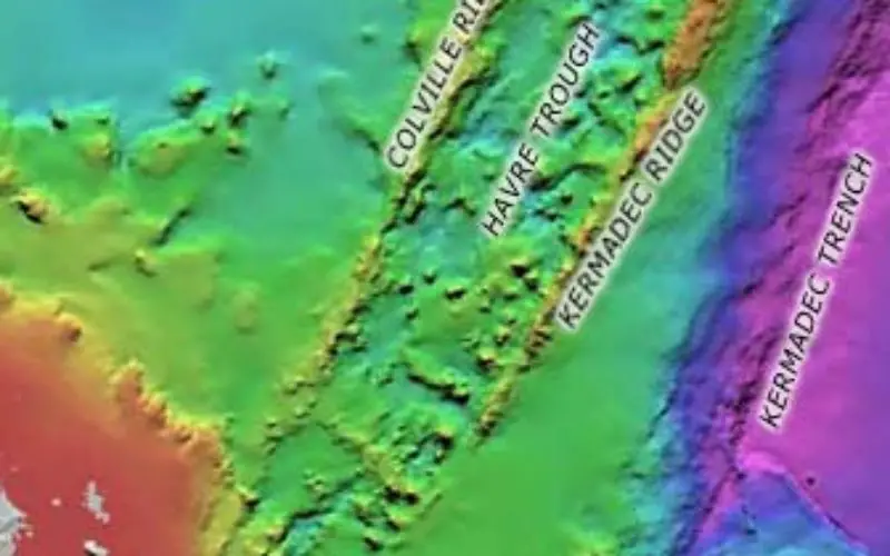
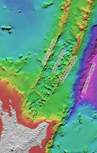
The Colville Ridge is stretching more than 200km towards Fiji. The state-of-the-art maps of New Zealand’s entire exclusive economic zones could prompt a rethink about the origin of the vast ridge – and perhaps even that of its wider area in the South Pacific.
“If the ocean was drained from this area, you would see an impressive but eroded chain of mountains similar to the Tararuas in the southern part of the North Island,” said the voyage’s chief scientist, Dr Cornel de Ronde, of GNS Science.
“Essentially, what we have done is strip the ocean away and so people can see this part of the Earth’s surface for the first time.”
“It’s amazing to think this area is only 200km east of Auckland and ships have been sailing over it for more than a century pretty much oblivious to what lay beneath.”
The new data revealed the ridge was far from entirely volcanic in origin, which had surprised some scientists.
“We set out to map what we thought was an ancient volcanic arc. We were surprised to find it wasn’t dominated by volcanic rocks, but more a mixture of them with large tracts of sedimentary rocks.”
“The Colville Ridge is a significant landmark on the face of the Earth – if you were standing on the plains either side of the ridge, the peaks would be 2km above your head.”
Source: The New Zealand Harald