
Archive

GIS Resources Magazine (Issue 4 | December 2018): Geospatial Technologies For Construction & Monitoring
GIS Resources Magazine (Issue 4 | December 2018): Geospatial Technologies For Construction & Monitoring December 19, 2018 – GIS Resources, a leading global platform for latest and high-quality information source of the
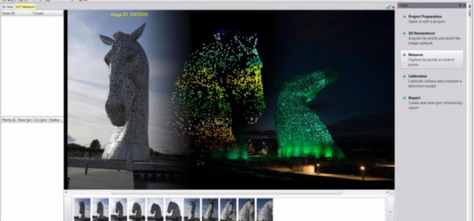
Trimble Inpho UASMaster 9.1 Now Available
UASMaster is one of Trimble’s UAS processing software solutions. UASMaster is engineered on the basis of the well-established Inpho advanced airborne photogrammetry/airborne LiDAR processing software suite. It offers full automatic geo-referencing, point-cloud
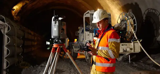
Geospatial Technologies for Infrastructure Construction & Monitoring
In an earlier editorial, on the concept and creation of smart cities, I had stated that ‘Most of the works or projects currently being taken up under the

Photography Is the Story I Fail to Put Into Words – Destin Sparks
Authored By: I love nature, I like to give an intense look at creativity, innovation and amazing architectures. When I look at all these, I wish my family, friends

Echolocation And Its Technological Developments
Authored By: Introduction Dolphins utilize echolocation to discover things in their surroundings. The clicking-noises they utter bounce off things under the water & goes back to this smart mammal.

Public/Private Datacube Partnership Launched
Datacubes are trending, and with the rasdaman datacube engine, they can even be federated across data centers. Users benefit from location transparency and planetary-scale fusion services. Now public and private
HARRIS Geospatial Solutions Webinar: The Applications and Benefits of Synthetic Aperture Radar (SAR)
Synthetic Aperture Radar (SAR) is rapidly becoming a key dataset in geospatial investigation. Unlike many other observational methods, SAR is not limited by illumination or cloud cover. In recent years,
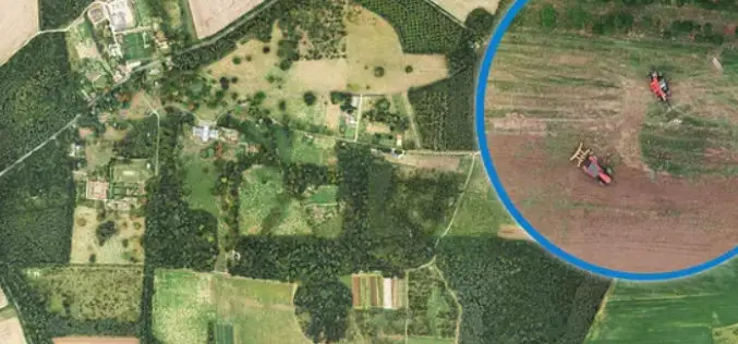
Bluesky Aerial Photomaps Help Outfield Reveal Secrets to Improving Farm Management
December 4, 2018 – Ultra high-resolution aerial photography and 3D landscape models from Bluesky are helping Outfield Technologies develop innovative image recognition techniques to improve agricultural land management and crop
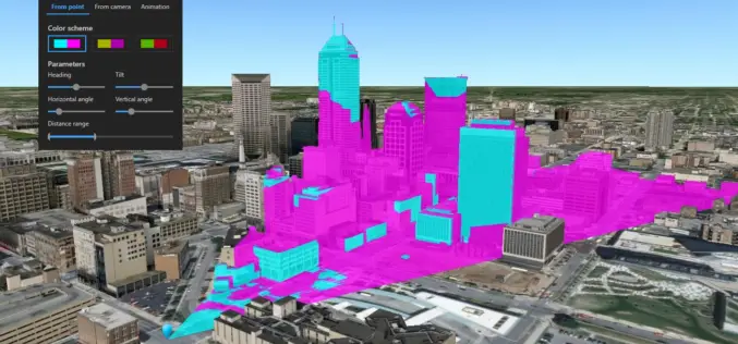
What’s New in ArcGIS Earth v1.8?
Recently Esri has introduced the latest version of ArcGIS Earth v1.8. ArcGIS Earth 1.8 delivers interactive analysis tools such as elevation profile, 3D measure, line of sight, and viewshed—with much more

HawkEye 360 Announces Successful Launch of First Three Satellites
The First Company to Commercialize RF Analytics Derived From Formation-Flying Satellites Herndon, Virginia (December 3, 2018) — HawkEye 360 Inc. today announced the successful launch of the company’s Pathfinder mission —
