
Archive
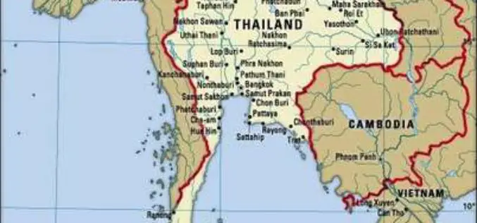
Airbus to Provide an End-to-end Geo-Information System to Thailand
Earth observation satellites, capacity building, integrated geo-information platform to support the Kingdom of Thailand’s key development priorities The Geo-Informatics and Space Technology Development Agency of Thailand (GISTDA) has selected Airbus
New 2018 Country Packages for the USA, Australia, Brazil, Canada, Mexico, New Zealand, and UK & Ireland
NEWTON, MASSACHUSETTS (USA) – Caliper is excited to announce the release of new 2018 Country Packages for its Maptitude mapping software. Maptitude Country Packages bring the power and flexibility of our
LANDSUPPORT Project Determines The Impact of Land Use
The EU funded LANDSUPPORT project officially launched on May 1st. The project partners, an international and complementary group of research centres, SMEs and policy makers, aim to develop an integrated
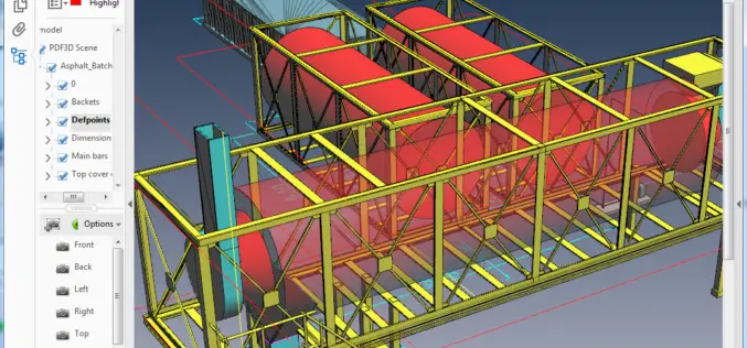
PDF3D Version 2.16 Focuses on CAD, CAE, Panoramic 360 and Engineering
PDF3D have released their latest update, Version 2.16, and deliver a powerful list of features for CAD users, CAE engineers, panoramic 360 photographers and 3D designers. June 25, 2018 –

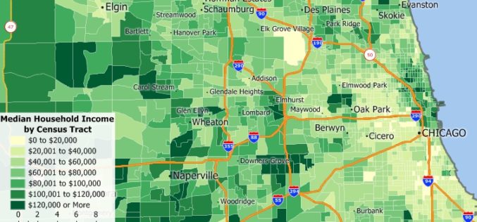
Free Business Location Data for Use with Maptitude 2018
NEWTON, MASSACHUSETTS (USA) – Point files with the locations for some of the largest U.S., Australia, Canada, and United Kingdom businesses are now downloadable for free for Maptitude 2018. The download includes point
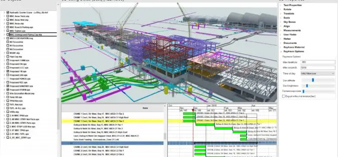
Bentley Systems Acquires Synchro Software to Extend Digital Workflows for Infrastructure Project Delivery Through 4D Construction Modeling
Introducing time dimension to synchronize BIM processes with work packaging, immersive visualization, and constructioneering, by way of Connected Data Environment (CDE) EXTON, Pa. – June 20, 2018 – Bentley Systems, Incorporated, a

Trimble Catalyst Now Supports GLONASS, Delivering Faster, More Accurate and Reliable Positioning Performance
Software-Defined GNSS Receiver Makes Updates Fast and Easy SUNNYVALE, Calif., June 19, 2018 – Trimble (NASDAQ: TRMB) announced today that its Trimble® Catalyst™ software-defined Global Navigation Satellite System (GNSS) receiver
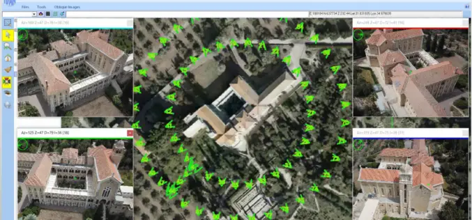
ObliMapper Transforming Drone Imagery into Actionable Visual Intelligence
Israeli company IDAN Computers Ltd. uses the TatukGIS Developer Kernel to develop its ObliMapper aerial drone image capturing, handling, and analysis tool designed to efficiently combine the benefits of orthophotos
GIS Resources Magazine (Issue 2 | June 2018): Geospatial Technologies for The Development in Rural India
GIS Resources Magazine (Issue 2 | June 2018): Geospatial Technologies for The Development in Rural India June 18, 2018 – GIS Resources, a leading global platform for latest and high-quality information source of the

Geospatial Technologies Will Play an Increasing Role in Rural Development
Rural development is a complex mix of fulfilling rural aspirations and providing opportunities and avenues to sustain their growth. Rural development is largely dependent on the demography &
