
Archive

Copernicus Satellite Data for Cultural Heritage Monitoring and Preservation
The free and open data and information delivered by the Copernicus programme represents a valuable resource for Cultural Heritage monitoring and preservation at European and global level. The data and
New Zealand Major Funding Boost for LiDAR Survey
Gisborne – April 6, 2018 – Gisborne District Council will receive over $1 million in funding to fly LiDAR across the entire district, a project that will bring major economic and

NASA ARSET Training: Monitoring Tropical Storms for Emergency Preparedness
Monitoring Tropical Storms for Emergency Preparedness Thursday, May 3, 2018 to Thursday, May 10, 2018 09:00 – 11:00 and 18:00 – 20:00 EDT (UTC-4) Tropical storms have major impacts, including loss of
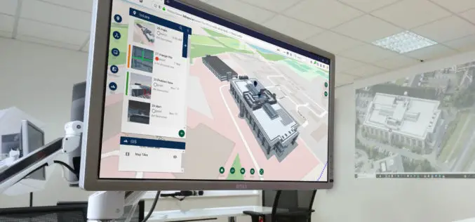
New 3D Repo Version Adds the Latest BCF Support and Further GIS Integration
London, 27 March 2018 – 3D Repo has released a new version of its cloud-based BIM platform that allows users to simultaneously access, via the web, the latest 3D construction models,
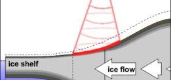
Remote Sensing to Detect Horizontal Motion of Glacier Grounding Lines
In a recent research by the UK Centre for Polar Observation and Modelling (CPOM) at the University of Leeds has produced the first complete map of how the ice sheet’s
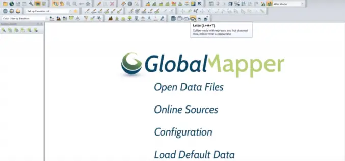
Update to Global Mapper Now Available with New Coffee-Making Toolbar
Hallowell, Maine – April 1, 2018 – Blue Marble Geographics (bluemarblegeo.com) is pleased to announce the immediate availability of an interim update to Global Mapper. This release introduces a major
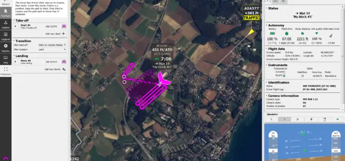
senseFly takes drone flight planning & management to next level with release of eMotion 3.5
The company’s acclaimed software—supplied with every senseFly drone—now includes CN and ES language support, integration with Agisoft PhotoScan, improved resume mission functionality and a new live air traffic data option
