
Archive

PDF3D V2.14 Release Meets Demands of Drones, Scanners and 3D Design Applications
PDF3D, leaders in 3D PDF conversion software, have today announced their new release and latest major update to the entire suite of products including PDF3D SDK, XML Server, ReportGen and
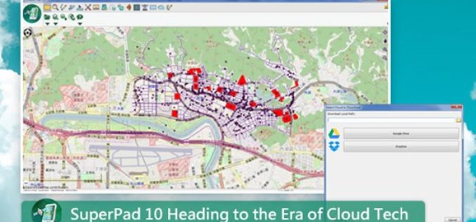
SuperPad 10 Heading to the Era of Cloud Tech
After years of research and development, the functionality of SuperPad, the professional mobile GIS software, is able to meet various demands of fieldworks. SuperPad 10, the new version released this

ISRO Successfully Launches Cartosat-2 Series Satellite Along with 30 Co-passenger Satellites
Jun 23, 2017 – ISRO’s Polar Satellite Launch Vehicle PSLV-C38 successfully launched the 712 kg Cartosat-2 Series Satellite along with 30 co-passenger satellites today (June 23, 2017) from Satish Dhawan Space
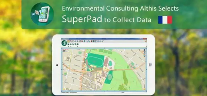
French Environmental Consulting Althis Selects SuperPad to Collect Data
Under the assistance of Géo.RM, Supergeo’s partner in France, the excellent mobile GIS software- SuperPad is earlier selected by the environmental consulting firm Althis for spatial data collection. Located in

Are You a Yoga Enthusiast? “Yogamplify” is Your One Stop Destination to Explore Events and Activities
21st June is celebrated as the International Day of Yoga, celebrated by millions at multiple venues across the world. Indian Prime Minister Narendra Modi introduced the idea of an International

Spanish Language Version of Global Mapper Now Available
Hallowell, Maine – June 19, 2017 – Blue Marble Geographics (www.bluemarblegeo.com) is pleased to announce that a Spanish language version of Global Mapper is now available. Developed in partnership with the company’s certified

Digital Image Evaluation Heading for New Markets
Karlsruhe/Berlin, 19, June 2017 | Digitalisation and the ubiquitous availability of images have resulted in a new golden age for photogrammetry! The driving force behind the processes is science, while

2nd Edition of GIS Resources Magazine: Smart Mapping Technologies for Smart Cities – Download it Now!
Thanks for your interest and downloading GIS Resources second edition. Subscribe our mailing list to keep updated of developments in the Geospatial domain. Click to Download Second Edition – Smart
Leica Geosystems’ GNSS Networks Now Support Galileo, QZSS
(Heerbrugg, Switzerland, 16 June 2017) Leica Geosystems, industry leader in measurement technology, released Leica Spider v7.0 software suite, supporting Galileo and QZSS constellations as well as the GPS-L5 signal for
Orbit GT Releases UAS Mapping v17.1 With Cloud Upload Feature at UAV EXPO, Brussels
Orbit GT releases v17.1 of its UAS Mapping desktop product including the all-new Upload to the Cloud feature. It is available for download today from our website www.orbitgt.com. “This upgrade includes
