
Archive

Airbus Global Earth Observation Challenge
Global Earth Observation Challenge Come up with new business ideas based on Satellite Data! You are a driven start-up ready to take on a challenge that uses the best technology
USGIF Universal GEOINT Certification Program
USGIF has launched a first-of-its-kind, transparent, and transportable Universal GEOINT Certification Program and professional designation that proves your deep and balanced understanding of the GEOINT tradecraft. The goal of the Universal GEOINT Certification Program is to provide
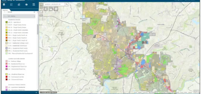
City of Roswell: A Case Study – Creating and Maintaining a GIS Enterprise
Introduction The bustling City of Roswellhas seen its population increase substantially over the course of the last twenty years, becoming the eighth largest city in the State of Georgia. Although

CompassDrone™ to Demo Integration of DJI Video with ArcGIS at Esri Mapping Forum
CENTENNIAL, Colorado, 29 June 2017 – Full motion video (FMV) captured by the best-selling drones in the world can now be viewed, queried and used for professional mapping projects in Esri ArcGIS.
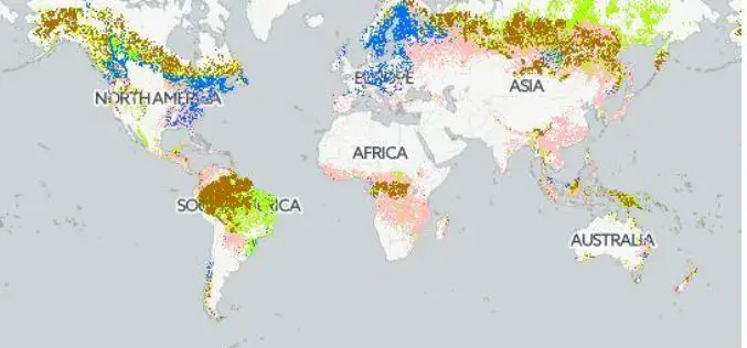
Safeguarding Sustainability Through Forest Certification Mapping
Using forest biomass products–such as timber, fuel wood, or paper–in a sustainable manner, without exhausting resources or diminishing forest biodiversity, requires transparency on the origin and management of those forests.
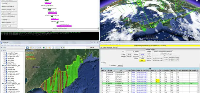
Cloud-Enabled Constellation Planning From Orbit Logic
GREENBELT, MD (June 26, 2017) – Orbit Logic announced today that they have released a new version of their Collection Planning & Analysis Workstation (CPAW) software with enhanced constellation collection planning
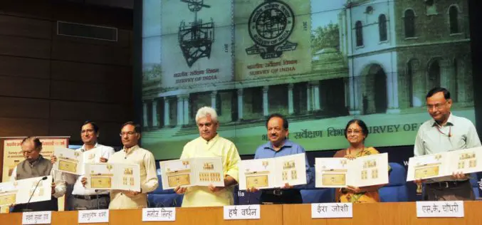
Survey of India Strives to Keep India Among the Best Surveyed Countries in the World-Manoj Sinha
Survey of India Strives to Keep India Among the Best Surveyed Countries in the World-Manoj Sinha Commemorative postage stamp released on 250th anniversary of Survey of India Minister of Communications

Global Mapper LiDAR Module v18.2 Now Features Hydro-Flattening Capability
Blue Marble Geographics has recently announced the release of Global Mapper version 18.2, the latest edition of the Module includes support for hydro-flattening from 3D lines or polygons when creating
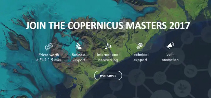
The Copernicus Masters Competition Countdown is On! Sign Up by 30 June
Earth Observation (EO) and big data possess a huge potential for the creation of innovative products and services. Many industries and areas of public interest benefit from the constant development
CompassCom to Debut Enhanced CompassTrac Enterprise Mobile Resource Management Solution at Esri User Conference
CENTENNIAL, Colorado, 27 June 2017 – CompassCom Software will unveil Version 7.1 of its industry leading mobile resource management (MRM) solution at the 2017 Esri User Conference. CompassTrac Enterprise, which
