
Archive
Orbit GT Releases Mobile Mapping Content Manager v17.1 With Cloud Upload Feature
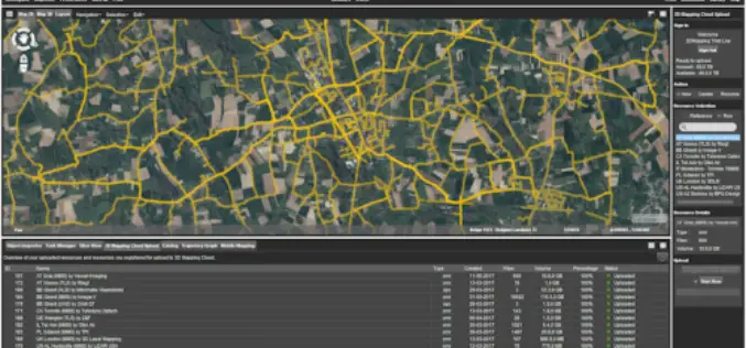
Orbit GT releases v17.1 of its industry-leading Mobile Mapping Content Manager product including the all-new Upload to the Cloud feature. It is available for download today from our website www.orbitgt.com.
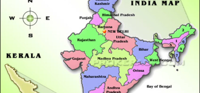
Space-based Services Should be Used: Kerala Tourism Minister
Thiruvananthapuram, May 19 (PTI) Applications of space-based services should be used by government agencies and departments for betterment of administration and society, Kerala Tourism and Devaswom Minister Kadakampally Surendran said
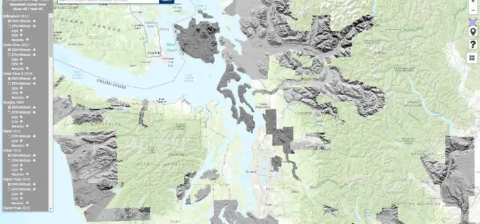
Washington State Department of Natural Resources Published New Landslide Mapping Standards Using LiDAR
Protocol standardizes methods for using LiDAR to map landslides in Washington State The Washington State Department of Natural Resources (DNR) has published standardized methods for mapping landslides in Washington using
Space Flight Laboratory (SFL) Signs Contract with Dubai Space Centre to Build Environmental Monitoring Satellite
TORONTO, Ontario, Canada – 17 May 2017 – The Space Flight Laboratory (SFL) of Toronto announced today the signing of a new contract to provide Dubai-based Mohammed Bin Rashid Space

Maharashtra Government to Spend INR 260 Crore for GIS Mapping of ULBs
According to recent news by TOI – The state cabinet on Tuesday sanctioned Rs 260 crore for GIS mapping(Geographic Information System) of all the C and D municipal corporations, Councils

Esri India Webinar: Mapping, Advanced Analytics and Sharing Maps with ArcGIS Desktop 10.5
Webinar: Mapping, Advanced Analytics and Sharing Maps with ArcGIS Desktop 10.5 Date: Thursday, May 25, 2017 | 11:00 AM IST onwards ArcGIS 10.5 is a big release; arguably one of

Varanasi the Spiritual Capital of India – a Journey Through Esri Story Map
Contributed By:- Varanasi (Kashi or Banaras) is a city in the northern Indian state of Uttar Pradesh dating to the 11th century B.C. Regarded as the spiritual capital of India,

30 Years of Success Leads DAT/EM to Virtual Reality and UAS
30 Years of Success Leads DAT/EM to Virtual Reality and UAS Anchorage, Alaska, USA. May 10, 2017- In 1987, a group of photogrammetric professionals envisioned a product that would bridge the
Icaros Releases Version 5.0 of OneButton™ Drone Image Processing Software
Icaros Releases Version 5.0 of OneButton™ Drone Image Processing Software Free 30-Day Trial FAIRFAX, Virginia, USA, 15 May 2017 – Icaros Inc., a leading provider of aerial imaging software, is pleased
ISRO to Set up Geospatial Outreach Research Facility in Hyderabad
The Indian Space Research Organisation (ISRO) will set up an outreach facility in Hyderabad, Telangana and it is a matter of pride for the state to be given this research centre.
