
Archive
PCI Geomatics Releases Geomatica 2017, Featuring Geomatica Object Analyst and Geomatica InSAR Modules
MARKHAM, Ontario, Canada — April 11, 2017: PCI Geomatics, a world leading developer of remote sensing and photogrammetric software and systems, announced today the release of Geomatica 2017 – the
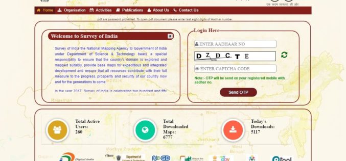
Survey of India Launches Web Portal to Download Maps
According to recent news reported by PTI, the government on Monday launched a website giving people the access to download 3,000 maps prepared by the Survey of India (SoI) but
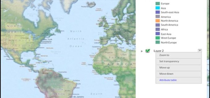
Towards a More Integrated Web GIS Solution – SuperGIS Server 10
When your company grows bigger as the project scale becomes larger, to organize huge volume of data wisely turns to be increasingly important. Based on the abundant experience of developing
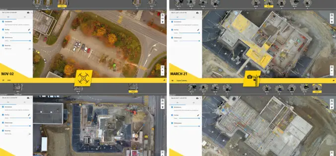
6 Major Construction Companies Adopt New Bim Monitoring Solution
Construction professionals understand that daily visualization of a job site helps minimize construction delays, prevent clashes between as-built and as design, eliminate the need for rework, facilitate stakeholder communication and

Next SuperSurv 10 Release Will Add Powerful Features
Equipped with advanced GIS and GNSS technologies, SuperSurv 10 is a cutting-edge mobile GIS app that operates on Android OS. After installing SuperSurv 10, field surveyors only need to bring

KAARTA Alters the Course of 3D Modeling With Launch of Contour
The first-of-its-kind device condenses 3D modeling to one product, one step, in real time Houston, TX-April 3, 2017 – Kaarta, innovator of the next big leap in 3D modeling, brings an
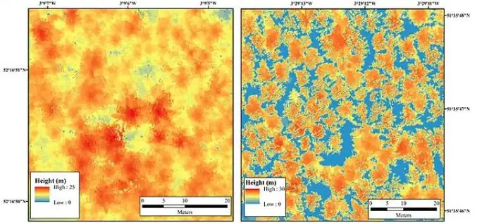
Bluesky LiDAR Maps Used to Monitor the Spread of Deadly Tree Disease
Laser maps collected by airborne mounted sensors have, for the first time, been used to successfully segment individual trees affected by the deadly Larch tree disease. The laser scanning surveys
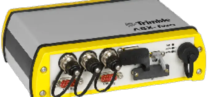
Trimble Introduces Compact, High-Performance OEM GNSS Sensor for System Integrators
SOUTHAMPTON, United Kingdom, April 6, 2017—Trimble (NASDAQ:TRMB) introduced today the Trimble® ABX-Two OEM GNSS sensor. The ABX-Two delivers precise heading, pitch, roll and 3D positioning information. With two internal MB-Two

Geo-tagging of Agricultural Land for Crop Management
According to recent by The Pioneer, the Ministry of Agriculture is going to sign a Memorandum of Understanding (MoU) with National Remote Sensing Center (NRSC), ISRO, for geo-tagging every piece
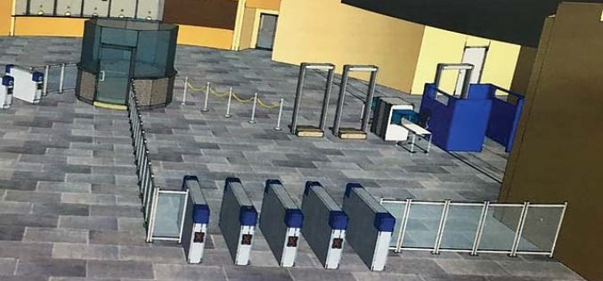
3D Mapping of Delhi Metro Station to Help CISF
New Delhi, India – According to recent news the DNA, all the major Delhi Metro stations have gone through the 3D mapping, this shall certainly help Central Industrial Security Force (CISF)
