
Archive
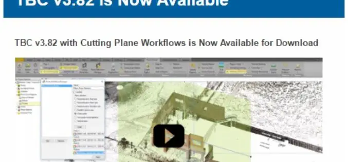
TBC v3.82 is Now Available
TBC v3.82 with Cutting Plane Workflows is Now Available for Download Trimble Business Center (TBC) is a geospatial office software that enables users to complete field-to-finish workflows efficiently and with

Earth-i Steps Up to Support the UK Space Industry
Earth-i has taken the opportunity to support the UK Space industry’s main gathering to discuss policy, progress and challenges by becoming a Gold Sponsor of the UK Space Conference 2017 held
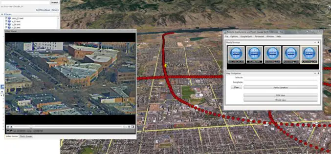
Remote GeoSystems Launches LineVision Google Earth Extension for Project Reporting with Geotagged Videos & Photos
Remote GeoSystems Releases All-New LineVision Google Earth Extension for Geotagged Video Playback, Analysis, Collaboration and Reporting Using Google Earth & Other GIS FORT COLLINS, Colorado – Remote GeoSystems, Inc. is

Bluesky 3D Laser Maps Will Help Protect Coastal Heritage Sites in a New €4 Million EU Project
Leicestershire, 30 March 2017 –The Royal Commission on the Ancient and Historical Monuments of Wales (RCAHMW) has commissioned aerial mapping company Bluesky to capture highly accurate laser maps of six

OGC Seeks Public Comment on ‘GML Application Schema – Coverages, GRIB2 Coverage Encoding Profile’ Candidate Standard
The Open Geospatial Consortium (OGC®) is seeking public comment on the candidate standard GRIB2 Coverage, an Encoding Profile of the OGC Coverage Implementation Schema. The candidate standard specifies the usage

Evolving Photogrammetry from Single-Pair Stereo to Multi-View rayCloud
Pix4Dmapper Pro’s rayCloud is a full-3D interface which allows visualization and analysis based on multi-ray intersections from 2D images. This provides a more accurate and consistent solution than extracting 3D

Bluesky Launches New Online Resource for Geographic Information of Ireland
Aerial mapping company Bluesky has launched a new online Mapshop to serve the rapidly expanding mapping and geographic information industry in Ireland. With tens of thousands of square kilometres of
Trimble Incorporates Galileo Support in New Version of its GNSS Infrastructure Management Software
Delivering Higher-Accuracy Positioning To Improve GNSS Network Performance and Reliability SUNNYVALE, Calif., March 27, 2017—Trimble (NASDAQ: TRMB) introduced today version 3.10 of its Trimble® Pivot™ Platform software, a modular solution

GIS Resources Step Ahead from e-Media to Print Media with their Launch of First Edtion
Mumbai, India – GIS Resources today announced the worldwide release of the GIS Resources first print edition (https://goo.gl/Kpst7b) of its quarterly edition in a year, the first edition focus on

Download Free – First Edition of GIS Resources Magazine
Thanks for your interest and downloading our first edition. Subscribe our mailing list to keep updated of developments in the Geospatial domain Click to Download Click to Subscribe
