
Archive

SimActive Used for Coastal Erosion Assessment with UAVs
SimActive Inc., a world-leading developer of photogrammetry software, is pleased to announce that Universiti Teknologi Malaysia (UTM) has chosen Correlator3D™ for its unmanned aerial vehicle (UAV) research. “We assessed photogrammetry
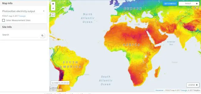
New World Bank Tool Helps Map Solar Potential
ABU DHABI, January 17 — The World Bank, in partnership with the International Solar Alliance (ISA), launched the Global Solar Atlas, a free, web-based tool to help investors and policymakers identify potential
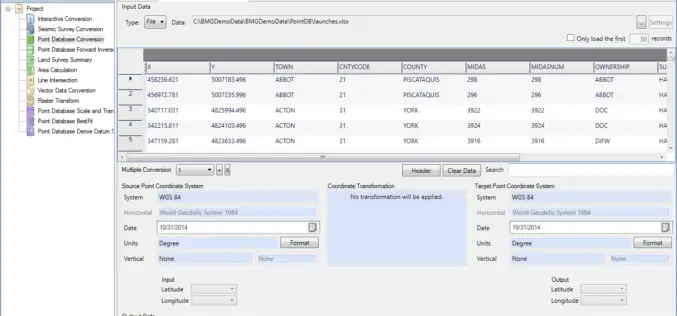
Geographic Calculator 2016 SP2 Release Coincides with the Unveiling of the New Cloud-Based Online GeoCalc Geodetic Registry
Blue Marble Geographics is pleased to announce the immediate availability of Geographic Calculator 2016 Service Pack 2 (SP2). This release includes numerous improvements to the usability of the software; updates

OGC Seeks Public Comment on OGC WaterML 2 – Part 3, Surface Hydrology Features Conceptual Model
The membership of the Open Geospatial Consortium (OGC®) seeks public comment on its WaterML 2 – Part 3, Surface Hydrology Features Conceptual Model. The OGC WaterML 2 – Part 3,

ICBA Workshop on Unmanned Aerial Vehicles for Remote Sensing and Photogrammetry
Unmanned Aerial Vehicles for Remote Sensing and Photogrammetry Monday, March 20, 2017 – Wednesday, March 29, 2017 International Center for Biosaline Agriculture (ICBA) is an international, non-profit agricultural research center

Airbus Launches “Enter the SpaceDataHighway” Challenge
• Aims to foster innovation for its brand-new laser-based space communication system. • Winner will be awarded €75,000 investment and will get support of Airbus BizLab. 12 January 2017 – Transmitting large
5 Drones for Precision Agriculture on Geo-matching.com
Drones (also known as Unmanned Aerial Vehicles) are used for various applications such as surveying, surveillance and habitat mapping. An interesting new application is precision agriculture. Drones can be used
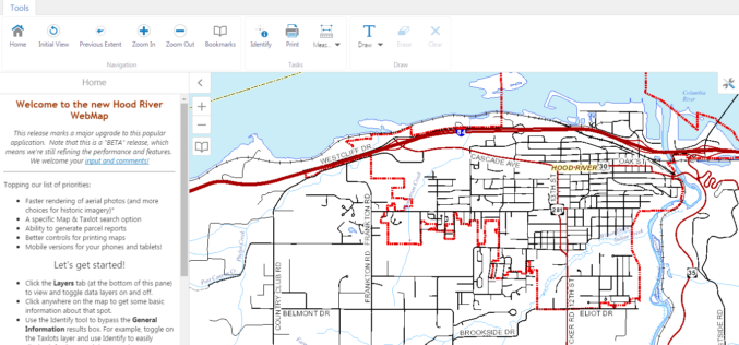
WebMap: Hood River County Releases New GIS Mapping Tool
Hood River County Geographic Information Services (GIS) Department has recently launched unveil a beta version of its interactive online WebMap application. The Hood River County Webmap application and its underlying

NASA ARSET Online Remote Sensing Training Announcement: Overview of the Global Disaster Alert and Coordination System
NASA ARSET Online Remote Sensing Training Announcement: Overview of the Global Disaster Alert and Coordination System (GDACS) Dates: Tuesday, February 21, 2017 Times: 8:00-10:00 a.m. and 5:00-7:00 p.m. EST (UTC-5) Up-to-date

City of Long Beach Launched GeoSpatial & Open Data Portal
Long Beach One of First Cities in U.S. to Display Open Data in Geospatial Data Format The City of Long Beach launched DataLB, the City’s new Open Data Portal on
