
Archive

Esri Unveils CityEngine Mobile Virtual Reality Solution
Customers Can Create and Share VR Experiences for Urban Planning Global smart-mapping leader Esri today announced a virtual reality (VR) solution for CityEngine, the company’s award-winning 3D modeling software. The
Esri ArcGIS 10.5 Release Transforms Spatial Analytics
Esri has released Esri ArcGIS 10.5 on December 19, the next-generation analytics technology includes the latest release of Esri’s enterprise GIS and unlocks the full potential of your data. Esri

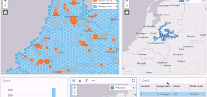
Illinois Wesleyan University Selects Geospatial Corporation’s GeoUnderground and GIS-Centric Smart-Asset Management Technologies
GeoUnderground Deployed to Improve Infrastructure Capital and Business Planning Pittsburgh Pennsylvania – December 19, 2016– Geospatial Corporation (OTCQB Symbol “GSPH”), a leading innovator of asset management/analytics/mapping software and 3D mapping

Iran Urges Russia to Start Building Remote Sensing Satellite
The Iranian minister for Communication and Information Technology, Mahmoud Vaezi, urged Russia to start work on constructing the remote sensing satellite both countries agreed upon earlier this year. Speaking in

TomTom and Microsoft Join Forces to Bring Location-based Services to Azure
Amsterdam, 15 December 2016 – TomTom (TOM2) and Microsoft announced today they will partner to bring enterprise-grade location-based services to Microsoft’s Azure platform, based on TomTom’s maps, traffic and navigation
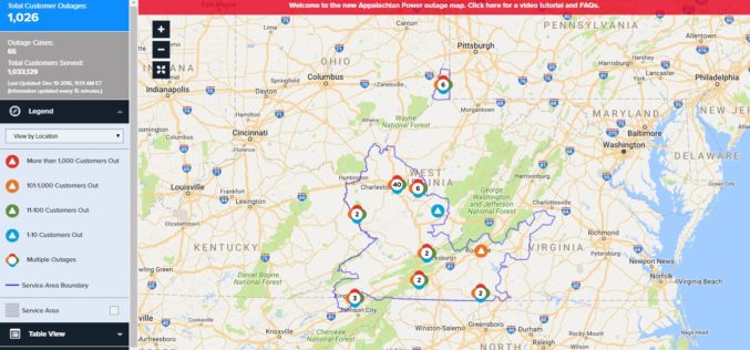
Appalachian Power Launches New Online Power Outage Information Map
CHARLESTON, W.Va., December 16, 2016 – Appalachian Power customers now have access to a new, interactive map that provides real-time information about power outages. Appalachian’s new outage mapping tool makes

Ordnance Survey’s Ground Breaking Planning and Mapping Tool for the National Rollout of 5G Technology
The holly and the 5G Bournemouth’s Christmas tree, lights and decorations feature in Ordnance Survey’s ground breaking planning and mapping tool for the national rollout of 5G technology. Bournemouth’s Christmas tree,
TBC Power Hour – UAS Processing using new TBC/UASMaster Workflows
TBC Power Hour Webinar: UAS Processing using new TBC/UASMaster Workflows Dec 21, 2016 | 8 AM MDT or 4 AM MDT UAS (Unmanned Aerial Systems) are becoming part of daily

NASA’s CYGNSS Launch Takes Surrey Satellite’s Space GNSS Receiver into Orbit
ENGLEWOOD, COLO. — Surrey Satellite Technology’s Space GNSS Receiver Remote Sensing Instrument (SGR-ReSI) is the primary payload onboard NASA’s CYGNSS constellation, launched today, December 15. The Cyclone Global Navigation Satellite System
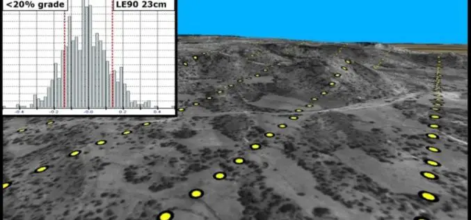
PhotoSat Publishes 21 New Satellite Surveying Accuracy Studies
21 PhotoSat surveying accuracy studies from seven different stereo satellites PhotoSat has published 21 new satellite surveying and mapping accuracy studies, now available on our website. The studies include data
