
Archive

International Conference on Urban Geoinformatics (ICUG) – 2017, Teri University, New Delhi
The rapidly-evolving field of urban Geoinformatics can play a pivotal role in the ‘smart cities’ of the future. TERI University is organising the inaugural edition of the International Conference on
Esri Publishes New Edition of Map Use: Reading, Analysis, Interpretation
Redlands, California—Esri, the global leader in smart mapping, has published Map Use: Reading, Analysis, Interpretation, eighth edition. Esri president Jack Dangermond called the 650-page textbook “a comprehensive primer for using
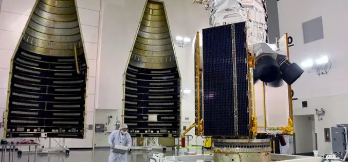
DigitalGlobe Announces the Successful Launch of WorldView-4 – Doubles DigitalGlobe’s Earth Imaging Capacity
WESTMINSTER, Colo.–(BUSINESS WIRE)–DigitalGlobe, Inc. (NYSE: DGI), the global leader in earth imagery and information about our changing planet, today announced the successful launch of WorldView-4, the company’s newest high-accuracy, high-resolution
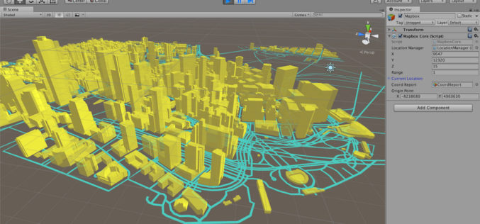
Mapbox Announces Unity SDK
Nov 10, 2016 – Today Mapbox has announced the new Unity SDK giving developers direct access to Mapbox from within Unity, bringing the full spectrum of Mapbox API’s to location-based

American Digital Cartography Release of WorldMap Digital Atlas v7.3.
Appleton, WI-USA – American Digital Cartography, Inc., a leader in providing comprehensive, current, and seamless geographic digital data for the whole Earth, is pleased to announce the release of ADC
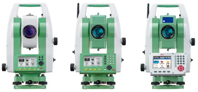
Leica Geosystems Acquires M&P Survey in the UK
In March 2016, Hexagon Geosystems, business division of Hexagon including Leica Geosystems, acquired M&P Survey Equipment Limited – one of the UK’s leading Leica Geosystems distributors. Since then, Hexagon Geosystems

Jamaica Acquired Satellite Imagery of the Island to Boost Spatial Data Infrastructure
Jamaica – According to the recent news reported by the Jamaica Observer, the National Spatial Data Management Division (NSDMD) in the Ministry of Economic Growth and Job Creation has informed

Airborne LiDAR to Throw Light on Rajgir Hill’s History
Kolkata,Nov 7, 2016- IANS – Indian archaeologists plan to deploy high-end scanning lasers on airborne platforms to survey the archaeological evidence, flora and fauna in the ancient Rajgir hills in
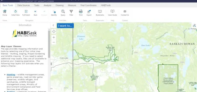
Government of Saskatchewan Launches New Hunting, Angling and Biodiversity Mapping Tool
The Ministry of Environment, Saskatchewan launched a new client-centred, online mapping tool called HABISask (Hunting, Angling and Biodiversity Information of Saskatchewan) that combines new and existing information on hunting, angling,

Trimble’s New SketchUp Viewer for Microsoft HoloLens Enables Users to Inhabit and Experience Designs
SketchUp with Mixed Reality Ushers in New Paradigm: Experiential Design Review LAS VEGAS, Nov. 7, 2016—Trimble (NASDAQ:TRMB) launched today its SketchUp Viewer for Microsoft HoloLens. The new mixed-reality solution allows
