
Archive

Agricultural Cooperative in Malaysia Manages Spatial Data with SuperGIS Desktop
The worldwide geospatial solution and GIS software provider, Supergeo Technologies Inc., is proud to announce that an agricultural cooperative in Malaysia has recently selected SuperGIS Desktop to manage spatial data.
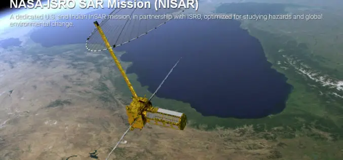
Opportunity for Young Scientist to be a Part of NASA-ISRO Synthetic Aperture Radar (NISAR) Data Program
AHMEDABAD: Here is a chance for young scientific researchers and data crunchers to be part of Isro’s ambitious NASA-ISRO Synthetic Aperture Radar (NISAR) satellite data analysis program. This will be
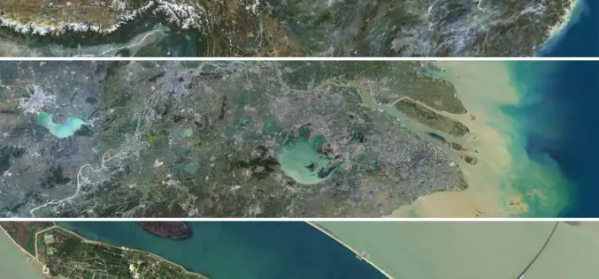
Release of PlanetSAT 15 L8 imagery Basemap of Asia by PlanetObserver
Clermont-Ferrand, 12 October 2016 – The French company PlanetObserver, specialized in imagery basemap production for more than 25 years, announced today the coverage of Asia with PlanetSAT 15 L8 basemap,
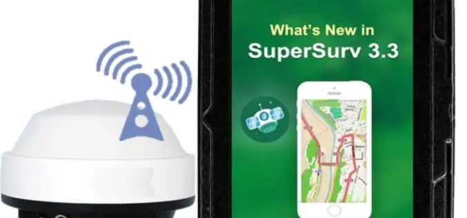
Boost Fieldwork Productivity with Latest SuperSurv 3.3
Supergeo Technologies Inc. has recently improved and released the latest version of SuperSurv, the leading mobile GIS software. Developed and maintained by the product team for years, SuperSurv is one

Trimble Sells its Unmanned Aircraft System Business to Delair-Tech
Strategic Alliances with Delair-Tech and Microdrones Expand UAS Platform Options While Leveraging Trimble Software and Data Solutions SUNNYVALE, Calif., Oct. 10, 2016—Trimble (NASDAQ: TRMB) announced today that Delair-Tech has acquired its
SimActive Launches Subscription UAV Software
SimActive Inc., a world-leading developer of photogrammetry software, is pleased to announce a new subscription-based offering for Correlator3D™ UAV. The rental option allows users with a dynamic workload to access

International Day of the Girl Child – 11 October
Contributed By: October 11, 2012, was the first Day of the Girl. Since then October 11 has been observed as the International Day of the Girl Child by the United Nations. The
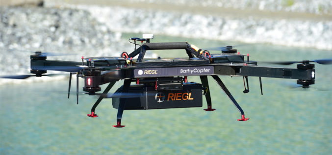
RIEGL with Broad and Impressive Product Range, New Products at Intergeo 2016
RIEGL uses the INTERGEO platform traditionally to give an insight and an overview on its comprehensive LiDAR sensors and systems product range. At booth C3.059 in hall A3, on the
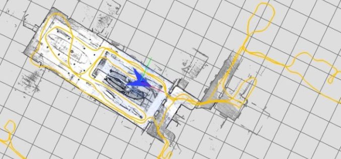
Google Releases LiDAR SLAM Algorithms, an Open Source Cartographer Mapping Solution
Google has released open-sourced Cartographer, a real-time simultaneous localization and mapping (SLAM) library in 2D and 3D with ROS (Robot Operating System) support. This technology which works with the open

Increased Use of Satellite Monitoring on the Norwegian Shelf
NOFO (Norwegian Clean Seas Association for Operating Companies) and KSAT (Kongsberg Satellite Services) has signed an extended agreement for satellite-based remote sensing, on the Norwegian Continental Shelf, for detection of
