
Archive
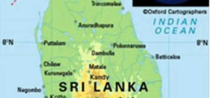
Sri Lanka Setting Up National Spatial Data Infrastructure for Development
According to recent news, Sri Lanka’s Survey Department is setting up national spatial data infrastructure where spatial or location-based information can be better used and shared by both the government

PrecisionHawk Webinar: Can Drones Really Be a Game Changer for Agriculture?
Can Drones Really Be a Game Changer for Agriculture? Thursday, October 27th | 1-2 PM Central Time You hear a lot about how drones will change the future of farming… but how

DataMapper Launches New Drone Data App – Waterpooling App
In the aftermath of an extreme rain event, insurance adjusters and growers have had to spend a significant amount of time in the field to approximate the extent of damage.

Mapbox Added 3D features in Mapbox GL JS
Mapbox added 3D features to Mapbox GL JS to take your maps to new heights! With the new extrusion properties, we can render 3D buildings/3D visualizations, visualize elevation profiles, build
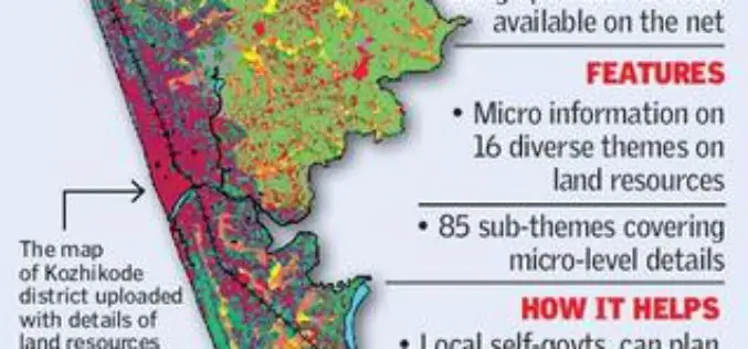
Kerala Launches GIS-based Land Information System
According to recent news by The Hindu, Kerala State Land Use Board (KSLUB) has launched Geographical Information System-based Land Resources Information System (LRIS). A 20-member team of the KSLUB has come out
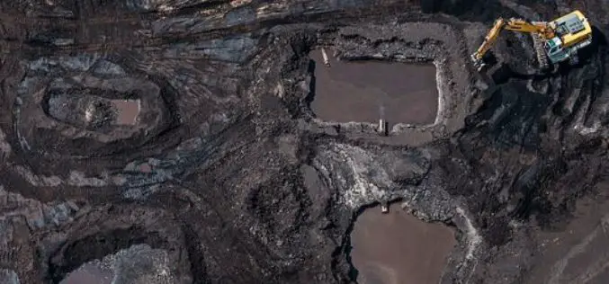
Government Launches Satellite-based Surveillance System to Monitor Illegal Mining
According to recent news by the PTI, In a path-breaking move, the mines ministry came out with a mining surveillance system (MSS), a pan-India surveillance network using the latest satellite
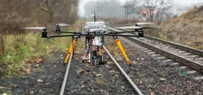
Union Railway Ministry Using Drones to Monitor Rail Project in Mumbai
According to recent news by the Hindustan Times, The Union railway ministry has been using drones to take updates on the developments of Seawoods-Nerul-Uran railway project. Drones are mainly being used

Centrik Helps Business Take Off for Self-regulating UAS Operators
UAS operators concerned by growing calls over regulation of the sector can now hold the key to successful self-regulation, thanks to operational management system Centrik. Already used by airlines, operators,
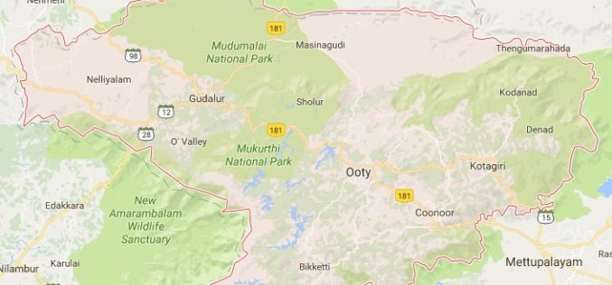
Geological Survey of India to Map Landslide-prone Zones in Nilgiris
According to recent news by TOI, almost three years back the Geological Survey of India (GSI) has started the process of mapping landslide-prone zones in the Nilgiris (Western Ghats of India),
Maharashtra Adopted Geospatial Technology to Digitize and Decentralise MGNREGA Works
According to recent news by the DNA, the Maharashtra State Government gearing up to implement the geographic information system (GIS) to digitize and decentralize the planning, monitoring, and implementation of the
