
Archive
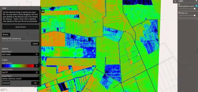
Hexagon Geospatial Launches Vegetation Health Smart M.Apps
Hexagon Smart M.Apps Help Pinpoint Where Crops Need Attention Hexagon Geospatial officially released seven different Vegetation Health Hexagon Smart M.Apps which make use of remote sensing algorithms to identify plant
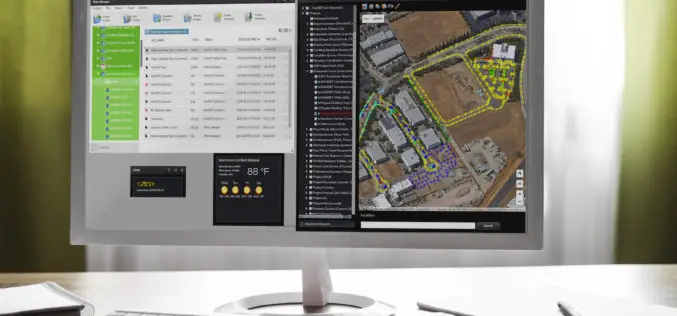
Topcon and Bentley Systems Announce Integration between Magnet 4.0 and Project wise
Creating bi-directional design through construction workflows LIVERMORE, Calif., USA/ CAPELLE A/D IJSSEL, The Netherlands, and EXTON, Pa., USA – June 2, 2016 – Topcon Positioning Group and Bentley Systems announce
Esri Brings GIS to Young Developers for National Day of Civic Hacking
Software, Training, and Technical Assistance Will Allow Teams to Create Innovative City Maps Redlands, California—Esri, the world’s leading supplier of GIS technology, will be on hand to support Hopeworks ‘N
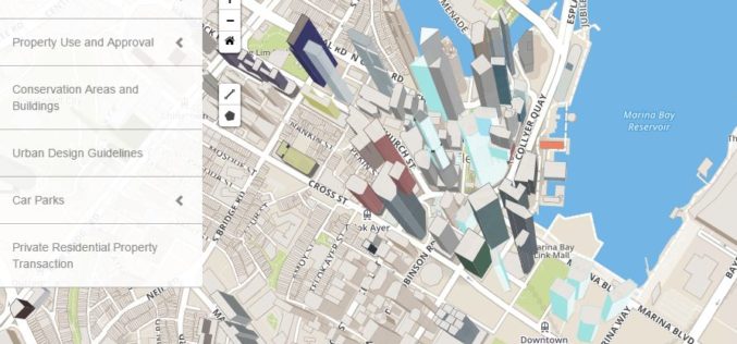
Singapore: Urban Redevelopment Authority Launches Online Portal for Information on Land Matters
Recently, the Urban Redevelopment Authority (URA) has revamped its online map services with new and enhanced features to make information more easily accessible and online transactions effortless. The new portal,

World View and Ball Aerospace To Jointly Explore Stratollite Platform for Remote Sensing Applications
Broomfield, CO – June 2, 2016 – World View, pioneers of the stratosphere, are collaborating with Ball Aerospace to explore World View’s Stratollite platform for remote sensing applications. Ball Aerospace
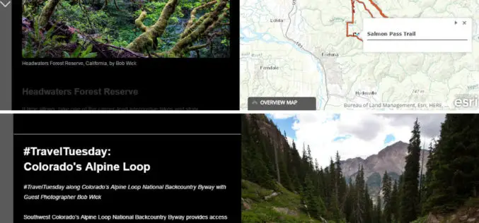
The Bureau of Land Management Uses Esri Story Maps to Encourage Public Land Exploration
Engaging the Public through the Travelogues of Wilderness Specialist Bob Wick Redlands, California—The Bureau of Land Management (BLM) now uses Esri Story Maps to encourage exploration of the United States’

Bangladesh Govt to Form National Spatial Data Infrastructure (NSDI)
According to recent news, Prime Minister Sheikh Hasina has said her government would soon form ‘National Spatial Data Infrastructure’ (NSDI) to generate geo-data and digital mapping aimed at country’s planned development.

Japan Adopted GIS-based Mapping to Protects Children’s Lives
According to recent news, the Chiba prefectural police has distributed commuting route maps among schools, indicating spots where students have been injured or killed in traffic accidents. The initiative was carried with
