
Archive

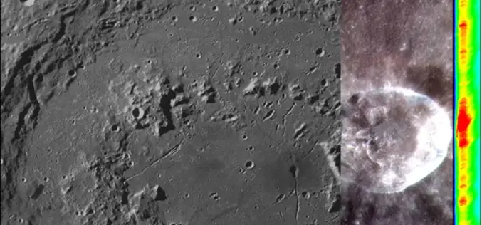
China Launches Tianhui-1 Remote Sensing Satellite
Beijing: China has successfully sent its third mapping satellite of the Tianhui-1 series into orbit on Oct. 26, 2015. Tianhui-1 will enhance the country’s ability to carry out scientific research, mapping and disaster
Opportunity for Utilizing Chandrayaan-1 Data from Terrain Mapping Camera and Hyperspectral Imager
Space Applications Centre (SAC), Indian Space Research Organisation (ISRO), Department of Space (DOS), Government of India, declares an “Announcement of Opportunity (AO)” to carry out scientific research by utilisation of
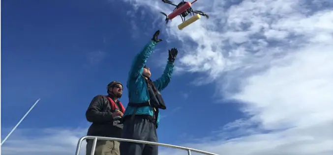
UAV to Study Killer Whales Health and Behavior
Unmanned aerial vehicle allows scientists to study killer whale health and reproduction while also offering a glimpse into the family life of these social animals John Durban is a marine

Joint Venture, U.S. Geological Survey Join Forces
Partnership to Tackle Earth and Atmosphere Challenges to Silicon Valley Joint Venture Silicon Valley and the U.S. Geological Survey today jointly announced a partnership to address regional challenges from natural

Aerial Mapping Pioneer Bluesky Supports Clean Energy Campaign
Aerial mapping company Bluesky is backing a charity’s campaign to protect the subsidies for clean energy projects. Under recent Government proposals, changes to the Feed-in-Tariffs (FiTs) for wind, solar and
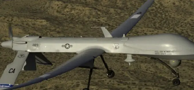
Drone Bombings in the Federally Administered Tribal Areas: Public Remote Sensing Applications for Security Monitoring
Drone bombing, as a US defense strategy in Pakistan, began under the George W. Bush administration as part of the “US War on Terrorism” and aimed to defeat Taliban and

How to Integrate Total Station, Level, and GNSS Data in Trimble Business Center
Webinar: How to Integrate Total Station, Level, and GNSS Data in Trimble Business Center Wed, Oct 28, 2015 7:30 PM – 8:30 PM IST (Show in My Time Zone) You’re invited

Esri’s ArcGIS Online Approved as a Grade 5-12 Learning Resource in British Columbia
Cloud-based mapping platform provides opportunities to develop students’ spatial & critical thinking If you’re an educator in British Columbia looking for a way to engage your students in various subjects

First Annual Commercial UAV Expo Gets Sky-High Marks from Industry Insiders
SPAR Point Group’s Commercial Drone Show Boasts 120 Exhibitors & 1,500 Attendees Commercial UAV Expo’s launch October 5-7, 2015 was lauded as a huge success for precision measurement professionals who
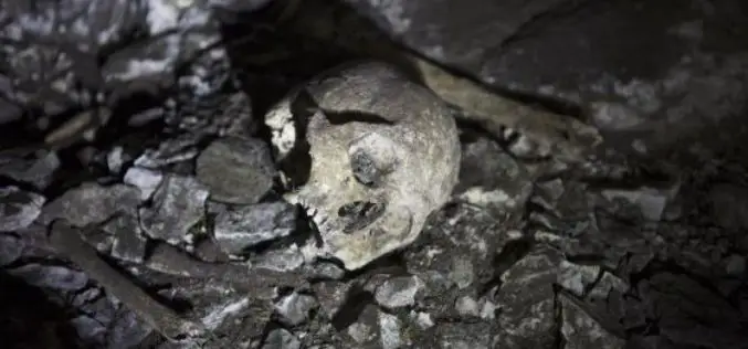
Satellite Imaging Helps to Find Site of Human Sacrifice
In recent news by EL PAIS, a team of Spanish scientist and researchers led by the writer and explorer Miguel Gutiérrez Garitano have just returned to Vitoria and shocked of
