
Archive

New State Map from Indiana Geological Survey Makes Use of High-Res Imaging
BLOOMINGTON, Ind. — The Indiana Geological Survey has published a new state map that features the latest digital technology using high-resolution elevation data. The map was prepared using lidar data
Australian Land Survey Firm Increases Map Quality by SuperGIS Desktop
Supergeo Technologies, the leading GIS software and solution provider, announces that SuperGIS Desktop assists Mesurage Group Pty Ltd, Australia to process surveyed data for value-added applications and services. Located in
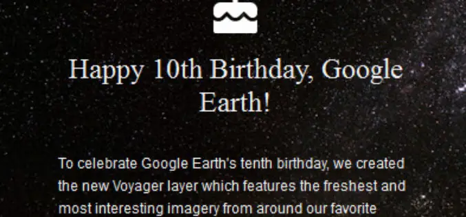
Celebrate Google Earth 10 Birthday with Two New Features
Happy Birthday, Google Earth! It has been a full decade to the launch of Google Earth, has provided the capability to visualize and analyze geographic data for various scientific applications

Geo-matching.com Adds Handheld Scanners Category
&bvsp; Lemmer, 30June 2015–Geo-matching.com has recently added Handheld Scanners to its broad spectrum of product categories.FARO Europe, DotProduct and Artec 3D Scannersare the first suppliers in this category.In addition to
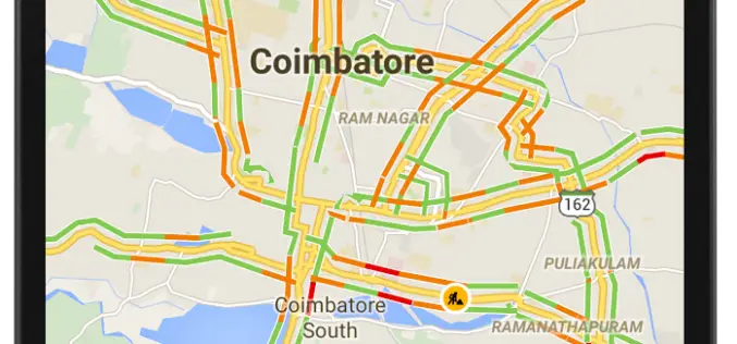
12 Cities in India to Get Live Traffic Updates Through Google Map
Never miss your flight or train, use Google Map to get real time traffic updates to route your drive around the traffic and save your time. Google has launched the

PCI Geomatics Launches Customer Support Website
MARKHAM, Ontario, Canada—June 30, 2015: PCI Geomatics, a world leading developer of remote sensing and photogrammetric software and systems, announced today that it launched a dedicated customer support website at

NASA Air Quality Remote Sensing Training for SESARM & GEPD
The goal of the NASA Applied Remote Sensing Training (ARSET) is to increase the utility of NASA earth science and model data for policy makers, regulatory agencies, and other applied

Google Maps Will Soon Alert Drivers about Railroad Crossings
According to The New York Times, the Federal Railroad Administration, United States of America and Google have agreed to update its maps with crossing locations. The new maps will ensure

Amazon Web Services – City on a Cloud Innovation Challenge 2015
Amazon Web Services simplifies IT workloads that governments struggle with every day, making it easier to deploy and manage the technology our customers depend on, such as Geographical Information Systems
