
Archive

Hexagon Geospatial Visualizes Stories with the Hexagon Smart M.App
Hexagon Geospatial is pleased to introduce the Hexagon Smart M.App, providing a new way to understand and share your geospatial experience. These new light-weight applications cohesively combine data, workflows, and analytics.
Soil Moisture Monitoring With Active-Passive Remote Sensing
Soil moisture is a key variable in controlling the exchange of water and heat energy between the land surface and the atmosphere through evaporation and plant transpiration. An assessment of surface soil

OGC announces Common DataBase Best Practice
27 July 2015. The Open Geospatial Consortium (OGC®) membership announces OGC’s approval of the OGC Common DataBase specification as an OGC Best Practice. This OGC Best Practice specifies an open

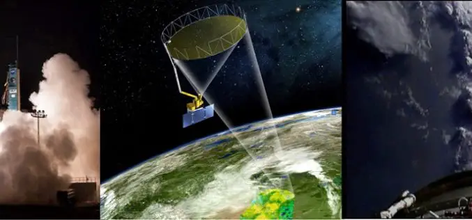
China Launches 2 Satellites to Build Homegrown Satellite Navigation System
BEIJING: China launched two new satellites into space Saturday, state media reported, as it builds a homegrown satellite navigation system to rival the US’s Global Positioning System. A rocket carrying the

Graduate Program in GIS at University of Maryland Graduate School
UMBC reflects the future of research universities. Young and dynamic, the university is small enough to provide personal attention, yet large enough to provide state-of-the-art facilities and the finest of

Esri Webinar: Create and Share ArcGIS Pro Tasks
ArcGIS Pro tasks are preconfigured steps that interactively guide a user through a specific workflow. Tasks make it easy for users of all GIS experience levels to complete standard workflows—from

Blue Marble Geographics Announces First Certified Trainer of Global Mapper
Blue Marble Geographics (bluemarblegeo.com) is pleased to announce that Engesat International S.A. of Brazil has successfully completed the training certification program. Together with his team, Laurent Martin, owner of Engesat
SuperGIS Server Extends Map Possibilities with Various Resources
This week, Supergeo releases the latest version of SuperGIS Server with plenty of new functions, including related tables, improved JavaScript print tool, and new JavaScript APIs supporting OGC layers. With
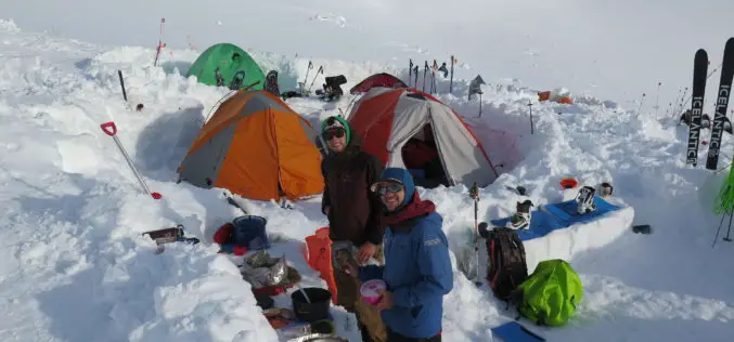
Mount McKinley Elevation Survey Results Coming Soon
Climbers return from the top of Mount McKinley to begin data analysis A team of four climbers has recently returned from the highest point in North America with new survey

Diploma in Geoinformatics from the University of Twente
The Faculty of Geo-Information Science and Earth Observation (ITC) delivers international postgraduate education, research and project services in the field of geo-information science and Earth observation using remote sensing and
