
Archive
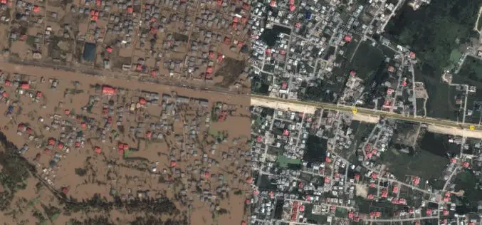
Kashmir Floods Monitored By Latest Satellite Technology
Union Minister Jitendra Singh said that Kashmir floods are being constantly monitored by latest satellite technology at the National Remote Sensing Centre. “Kashmir floods are being constantly monitored by latest

Smartone C from Smartplanes Reviewed By the Geo-Matching Community
The Geo-matching.com website features a selection of the most important geomatics equipment, including UAS for Mapping and 3D Modelling. At www.geo-matching.com, you can compare product specifications and read users’ reviews
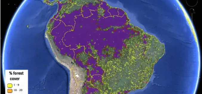
More Accurate View of Global Forest Map from IIASA
New global forest maps combine citizen science with multiple data sources, for an unprecedented level of accuracy about the location and extent of forestland worldwide. At International Institute of Applied
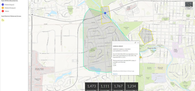
Esri Releases Nighttime Flow Analysis Solution to Identify Water Loss in Metered Service Areas
New Esri Solution Uses Location Analytics to Slash Discovery Time of Nonrevenue Water Loss at Utilities Redlands, California—Esri this month announced the release of its Nighttime Flow Analysis solution. This
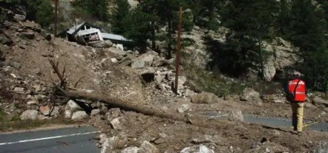
Aerial LiDAR to Study Impact of Colorado Flood on Soil Erosion
Anderson and colleagues use repeat aerial LiDAR to quantify the erosional impact of the heavy rains that inundated the Colorado Front Range in September 2013. One week of steady rain and
Newly Released US Topo Maps for California Now Feature Selected Trails
Newly released US Topo maps for California now feature selected trails and other substantial updates Several of the 2,798 new US Topo quadrangles for California now display public trails along
