
Archive

Supergeo Renews Partnership with Star Vision for GIS Development in Southeast China
Supergeo Technologies, the global leading GIS software and solution provider, announced the extended partnership with Star Vision, the professional GIS consulting and surveying firm in Hong Kong, to further develop

To Drive Economic Growth and Digital Innovation through Open Data
To coincide with International Open Data Day, when countries across the globe will show their support for open data policies, Ordnance Survey (OS) announce plans to launch a world-leading digital map

ESA’s Earth Explorer Mission to Study Vegetation Biomass
Following the initial selection in 2013 for Biomass to become ESA’s seventh Earth Explorer mission and the completion of preparatory activities, ESA Member States yesterday gave the green light for
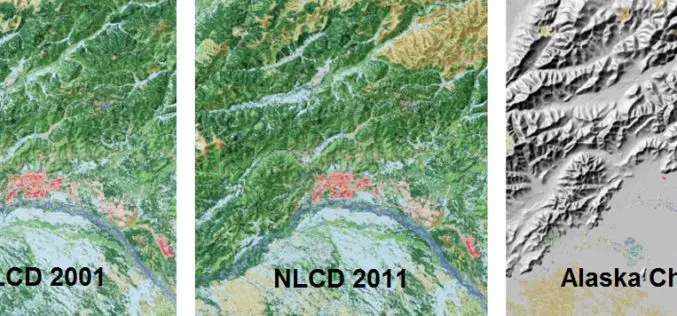
A Decade of Change in America’s Arctic: New Land Cover Data Released for Alaska
The latest edition of the National Land Cover Dataset (NLCD 2011) for Alaska is now publicly available. The extensive NLCD database continues to add to our understanding of where land

New Esri Book Applies the Science of GIS to Literature, History, and Culture
Maps created using geographic information system (GIS) technology can be used to explore and interpret events in literature, history, and culture. That’s the premise of Abstract Machine: Humanities GIS, a
Intelligence In The Cloud
Lockheed Martin And Esri Cloud Deployment Enables Geospatial Information Sharing Across Intel Community Lockheed Martin [NYSE: LMT] and Esri have deployed commercial software to the Amazon Web Services Commercial Cloud
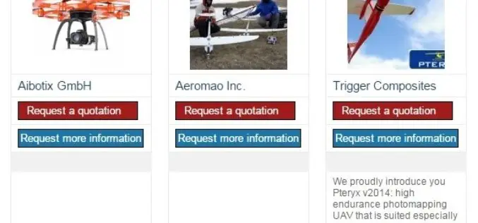
The 5most viewed UAVs for Mapping and 3D Modelling on Geo-matching.com
The Geo-matching.com website features a selection of the most important geomatics equipment, including UAS for Mapping and 3D Modelling. At www.geo-matching.com you can compare product specifications and read users’ reviews

Webinar: Agricultural Monitoring Workflow Using Geomatica and Free Landsat-8 Imagery
Agricultural Monitoring Workflow Using Geomatica and Free Landsat-8 Imagery Freely available Landsat-8 imagery can be used as an initial no-cost pass to monitor agricultural crop health, in order to identify

DOT and FAA Propose New Rules for Small Unmanned Aircraft Systems
Regulations Will Facilitate Integration of Small UAS into U.S. Aviation System Washington – The Department of Transportation’s Federal Aviation Administration today proposed a framework of regulations that would allow routine
Digital Aerial Solutions Expands Mapping Services with Purchase of Leica ALS80 Laser Scanner
Leica Geosystems Inc. today announced that Digital Aerial Solutions (DAS), a woman-owned small business based in Tampa, Fla., is the first company in North America to purchase the ALS80 laser
