
Archive
Statistics Map APIs Service Platform
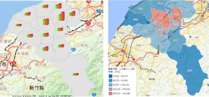
Displaying statistical data on map extends GIS applications to more domains, as it is much easier and more informative for researchers to comprehend meanings of the data through its intuitive
Google to Put-down Google Earth API
Oops ! Developers making 3D mapping applications now have to look for another APIs source as as Google is withdrawing support for Google Earth API. Google has introduced Google Earth

ArcGIS Explorer is Now Available for Android
Finally the long awaiting ArcGIS Explorer on Android is now available in the Google Play Store. ArcGIS Explorer is a free GIS viewer that gives you an easy way to
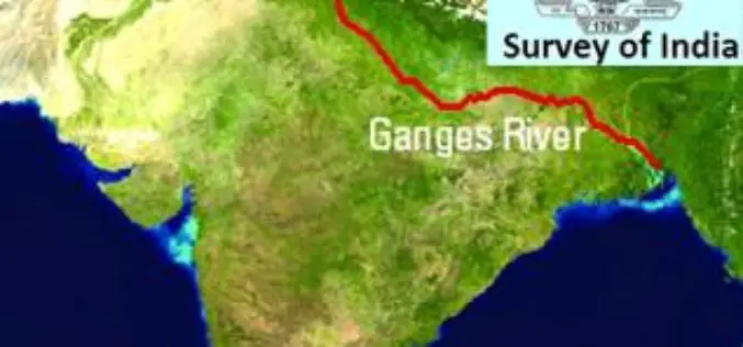
Survey of India to Soon Map Ganga River
Dec. 16, 2014, India – The Survey of India would soon begin work to map and survey Ganga river at an estimated cost of Rs 542 crore that will determine

New 3D imagery for Google Earth
Since 2006, we’ve had textured 3D buildings in Google Earth, and we’re excited to announce that we’ll begin adding 3D models to entire metropolitan areas to Google Earth in the

Geospatial Technology to Bring More Tourists to Queensland
GIS People has once again taken out the competition in Queensland Government’s Open Innovation Challenge, and this time won the opportunity to develop an intelligent data management solution for the
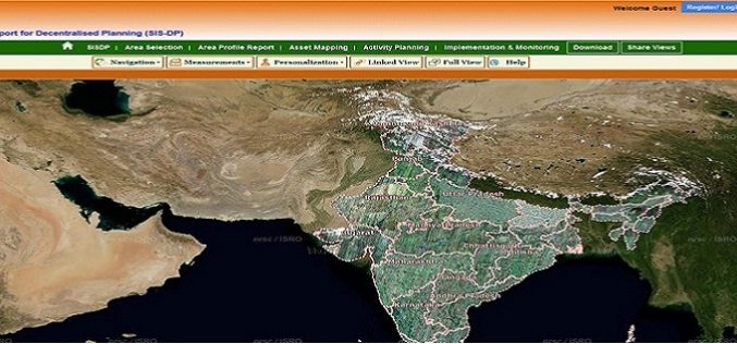
ISRO Empowering Panchayati Raj Institutions using Bhuvan Panchayats
Bhuvan Panchayats Portal plays an important role to disseminate the deliverables of the project including High Resolution Satellite Imagery and Resource Maps at 1: 10,000 scale, to the three levels
Survey of India Files Complaint against Google
Survey of India on Saturday filed a complaint with the police against Google maps for alleged wrong depiction of India’s international boundaries. Dalanwala Police station in charge Anil Kumar Joshi

GeoCue Group Announces Release of GeoCue 2014.1
Huntsville, AL – GeoCue Group Inc. is pleased to announce the release of GeoCue 2014.1. GeoCue is the world’s most powerful and popular geospatial production management software, available as a

Webinar: Geomatica 2014 and LiDAR for Accurate DEM Creation
Geomatica 2014 and LiDAR for Accurate DEM Creation On-demand webinar: Digital Elevation Models (DEMs) play an important role in terrain-related GIS applications. Chief among the many factors that affect the
