
Archive

Two Publications on How to Best use Remote Sensing Data at a 1-km scale
The NCEAS Environment and Organisms Working Group set about to assemble a state-of-the-art set of environmental layers that incorporate well-known but rarely used measures that have direct links to
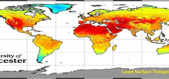
GlobTemperature Project an European Space Agency (ESA) Due Initiative
The European Space Agency (ESA) has launched a new project – GlobTemperature to capture earth land surface temperature (LST) at global scale. Instruments like thermometer there are several satellite sensor
How to Download Landsat Satellite Data?
In this exercise you will learn, how to download Landsat satellite data? The USGS Earth Resources Observation and Science (EROS) Center archive holds data collected by the Landsat suite of
Secrets to Amaze Your Business Users with Location Intelligence
Onix has been a Google partner since 2001, and was named by Google as the “Global Partner of the Year – Enterprise Search” in both 2012 and 2013, and “Google

Webinar: Responding to Natural and Urban Environment Changes with 3D GIS Tech
Responding to Natural and Urban Environment Changes with 3D GIS Tech When natural and human-made disasters occur in urban area, how do we respond and minimize the damage with GIS
