
Archive
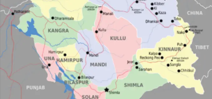
Glaciers and Lakes Mapping in Himachal Pradesh
In recent new, Scientists are mapping the glaciers and lakes in Himachal Pradesh keeping in mind the climate vulnerability and hazards. State Centre for Climate Change will map all glaciers
Highway App by West Bengal Highway Development Corporation
In recent news, tourists in West Bengal will get all the information they need on state highways at the touch of a button, courtesy a mobile phone app that informs

PR: New York State Police Implement GeoComm Mapping in New Call Center
The New York State Police (NYSP) recently worked with GeoComm to implement a new tactical 9-1-1 mapping system. GeoLynx Server was installed at the new Troop G Communications Center in

Webinar: Streamlining Field Survey & Mobile Mapping by SuperSurv
Supergeo Webinar: Streamlining Field Survey & Mobile Mapping by SuperSurv Join us on Wednesday, June 4th 11:00 AM – 12:00 PM (EDT, New York Time) How could smart devices assist in field survey
SuperGIS Server Silverlight API Samples Supports Powerful Network Analyses
Supergeo Technologies provides rich API samples for GIS developers to effortlessly customize web map services through SuperGIS Server 3.1a. Among them, SuperGIS Server Silverlight API newly includes the samples indicating
Implementation of GPS Based Vehicle Tracking and Monitoring System
Implementation of GPS Based Vehicle Tracking and Monitoring System, Municipal Corporation of Greater Mumbai Project Background : From private sector to public sector, to productivity and back office procedures, technology has pervaded
RFP: Design, Development, Implementation, Management and Maintenance of an Enterprise Level Geospatial Atomic Mineral Exploration Database
Director, Atomic Minerals Directorate for Exploration and Research (AMD), Begumpet, Hyderabad, on behalf of the President of India, invites sealed bids in three parts (Pre-qualification, Techno-commercial and Price) from eligible
GEOCROWD Summer School – Creating a Geospatial Knowledge World
GEOCROWD – Creating a Geospatial Knowledge World Summer School II (St Andrews) – D4.6 – 14th-17th July Centre for GeoInformatics at University of St Andrews is pleased to announce it will run a GEOCROWD
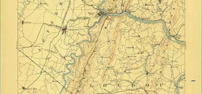
Revised North Dakota, Delaware and Maryland Maps Feature New Design
Newly designed US Topo maps covering North Dakota, Delaware and Maryland are now available online for free download US Topo maps now have a crisper, cleaner design – enhancing readability of
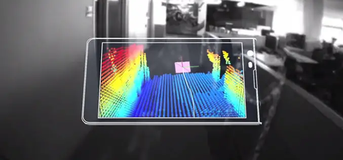
Say hello to Project Tango!
Project Tango is an exploration into giving mobile devices a human-scale understanding of space and motion. What if you never found yourself lost in a new building again? What if
