
Archive
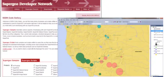
Supergeo Launches Rich Customization Samples of SuperGIS Desktop 3.2
Supergeo Technologies, a leading global provider of GIS software and solutions, released plentiful customization samples and technical resources of SuperGIS Desktop 3.2. GIS developers and programmers are empowered to build

Ph.D. Research Programmes at JNTUH Hyderabad
Admission To Full Time Ph.D. Research Programmes (Under TEQIP-II)-2014 JNTU has been deemed an autonomous one after Act No 30 of the approval of the Andhra Pradesh Legislature known as
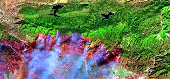
Satellite Images Reveals 2,500 hectares Forest Lost in Fire
In recent news, recent satellite image analysis of Bandipur and Nagarahole National Parks reveals that nearly 2,500 hectares of forest has been lost in a forest fire began over a week ago on
A New Index for Delineating Built-up Land Features in Satellite Imagery
A New Index for Delineating Built-up Land Features in Satellite Imagery H. XU College of Environment and resources, Fuzhou University, Fuzhou, Fujian 350108, China Download full paper in PDF

Supervised Classification of Agricultural Land Cover Using a Modified k-NN Technique (MNN) and Landsat Remote Sensing Imagery
Supervised Classification of Agricultural Land Cover Using a Modified k-NN Technique (MNN) and Landsat Remote Sensing Imagery Luis Samaniego and Karsten Schulz Abstract: Nearest neighbor techniques are commonly used in remote sensing,
Solving Optimization Problems using the Matlab Optimization Toolbox – a Tutorial
Solving Optimization Problems using the Matlab Optimization Toolbox – a Tutorial TU-Ilmenau, Fakultät für Mathematik und Naturwissenschaften Dr. Abebe Geletu Download Solving Optimization Problems using the Matlab Optimization Toolbox – a Tutorial
Decision Tree Land Use/ Land Cover Change Detection of Khoram Abad City Using Landsat Imagery and Ancillary SRTM Data
Decision Tree Land Use/ Land Cover Change Detection of Khoram Abad City Using Landsat Imagery and Ancillary SRTM Data Hamid Reza Matinfar and Majid Shadman Roodposhti Abstract: Change detection is a general
Urban Sprawl Mapping And Land Use Change Analysis Using Remote Sensing And GIS (Case Study Of Bhubaneswar City, Orissa)
Urban Sprawl Mapping And Land Use Change Analysis Using Remote Sensing And GIS (Case Study Of Bhubaneswar City, Orissa) Monalisha Mishra, Kamal Kant Mishra, A.P. Subudhi Abstarct: This project examines

A Two-Source Time-Integrated Model for Estimating Surface Fluxes Using Thermal Infrared Remote Sensing
A Two-Source Time-Integrated Model for Estimating Surface Fluxes Using Thermal Infrared Remote Sensing M. C. Anderson, J. M. Norman, G. R. Diak, W. P. Kustas, and J. R. Mecikalski Abstract: We
Estimation of Daily Evapotranspiration by Three-Temperature Model At Large Catchment Scale
Estimation of Daily Evapotranspiration by Three-Temperature Model At Large Catchment Scale Y. J. Xiong , G. Y. Qiu, J. Yin, S. H. Zhao, X. Q. Wu , P. Wang ,
