
Archive

AutoTrace Plugin for QGIS
AutoTrace is a plugin for QGIS that allows you to trace existing features. The AutoTrace plugin is based on the traceDigitize plugin by Cédric Möri and others. Installation AutoTrace is available from the

2014 Call for Submissions – Atlas of Design: North American Cartographic Information Society
The North American Cartographic Information Society invites submissions for the Atlas of Design, a publication dedicated to honoring beautiful and interesting maps from around the world. All mapmakers are encouraged to
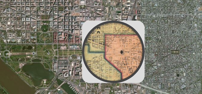
Federal Agencies ‘Mapping and Apping the Nation’
Maps today are much more than an outline of shapes and landmarks. We use them all the time in combination with the vast amount of information available online to plan
Introducing Geocortex Essentials 4.0
This introduction comes from Geocortex Blog by Latitude Geographics written by Drew Millen on Feb. 05, 2014 … After eighteen months of infrastructure development, we have reached an important milestone in
Isotropic Depleted Mantle Model Age Map of Australia
Geoscience Australia has released the Samarium-Neodymium (isotope) depleted mantle maps of the Australian continent. This view included the investigation of Australia’s lithospheric architecture to establish a whole-of-lithosphere architectural framework as a
Navitel Navigator Releases Q1 2014 Update of Maps of Europe, Central Asia, Russia and Turkey
Q1 2014 update of NAVITEL® maps of Europe, Central Asia, Russia and Turkey announced! The users of Navitel Navigator can update maps of Europe, Central Asia, Russia and Turkey up to the Q1 2014 version. The Q1 2014
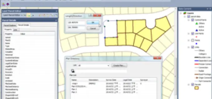
PR: Land Parcel Editor in SuperGIS Desktop Allows to Manage Parcel Data with Ease
Supergeo Technologies, a leading global provider of complete GIS software and solutions, announced that SuperGIS Desktop 3.2, the newest desktop GIS software, supports Land Parcel Editor to assisting users in

PhD Fellow in Land Change Science at University of Copenhagen
The Department of Geosciences and Natural Resource Management, Faculty of Science at University of Copenhagen is offering a PhD scholarship in land change science commencing 01.05.2014 or as soon as
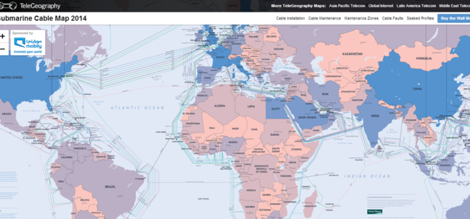
Submarine Cable Map of The World
TeleGeography is a telecom firm. TeleGeography has recently released the updated version 2014 of Submarine Cable Map. The latest version of map shows 285 cable systems current in active state or

SPLIT REMOTE SENSING SUMMER SCHOOL 2014 (SplitRS 2014)
SPLIT REMOTE SENSING SUMMER SCHOOL 2014 (SplitRS 2014) Remote Sensing Data and Information Location: Split, Croatia Date: 22 and 23 May 2014 SplitRS 2014 is intended for PhD students and early
