Credit: Esri
ArcGIS Earth is off to a great start with thousands of downloads and an engaged community of global users. We are happy to release the 1.2 version and excited to share some of the new key capabilities that deliver on many of your requests. You can now use ArcGIS Earth offline and connect with more of the data in your organizations. Here are some highlights:
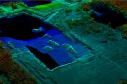
Support for more 3D data: ArcGIS Earth now supports integrated mesh data and large continuous meshes, generated by Drone2Map for ArcGIS and companies like Vricon, Pix4D, and Bentley Systems. Add multiple elevation surfaces and set your own basemaps.
Offline use: Add mesh and 3D object layers using Scene Layer Package (SPK) files. Bring imagery and elevation through local files. Whether offline or online, CSV/TXT files and drawing elements can be saved as KMZs.
More enhancements: Set measurement units in application settings for coordinate display, distance, and area. The workspace save directory location can be saved, and workspaces can be recovered from previous saves.