
Tag "West Virginia"
GIS
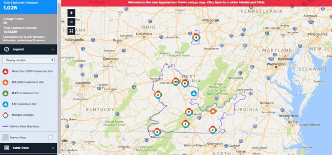
Appalachian Power Launches New Online Power Outage Information Map
CHARLESTON, W.Va., December 16, 2016 – Appalachian Power customers now have access to a new, interactive map that provides real-time information about power outages. Appalachian’s new outage mapping tool makes
GIS
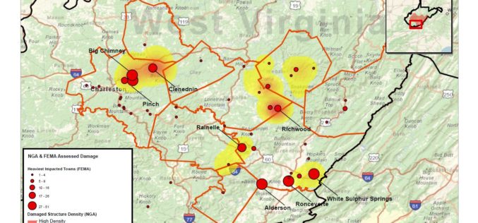
National Geospatial-Intelligence Agency Provides Expertise Response to West Virginia Flooding
As reported in a recent news bulletin by The National Geospatial-Intelligence Agency (NGA), NGA is providing geospatial expertise and damage assessments to the Federal Emergency Management Agency (FEMA) for flooded
