
Tag "Vegetation Indices"
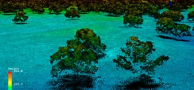
Full Waveform LiDAR Sample Data Now Available For Free
In a recent announcement by NEON, NEON Airborne Observation Platform (AOP) sample data is now available on the Airborne Data page. The NEON Airborne Observation Platform (AOP) is an aircraft
Why does NDVI, NDBI, NDWI Ranges From -1 to 1?
The indices calculated from satellite imageries such as Normalized Difference Vegetation Index (NDVI), Normalized Difference Built Index (NDBI) and Normalized Difference Water Index (NDWI) have indices value ranges from -1
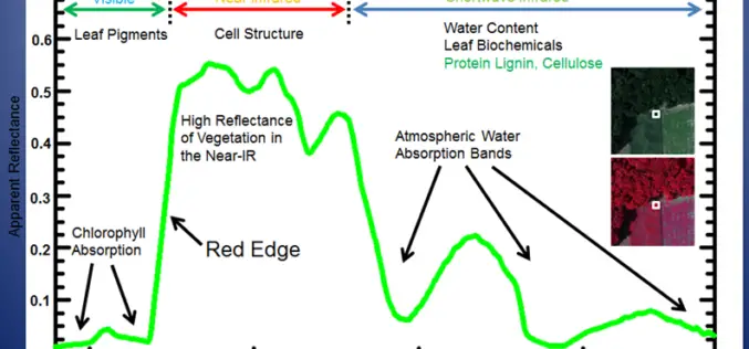
Evaluation of Narrowband and Broadband Vegetation Indices for Determining Optimal Hyperspectral Wavebands for Agricultural Crop Characterization
Evaluation of Narrowband and Broadband Vegetation Indices for Determining Optimal Hyperspectral Wavebands for Agricultural Crop Characterization By: Prasad S. Thenkabail, Ronald B. Smith, and Eddy De Pauw Abstract: The main goal
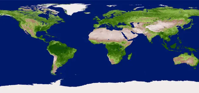
Vegetation Indices
Vegetation Indices has proved to have an extremely wide (and growing) range of applications. It is used to monitor vegetation conditions and therefore provide early warning on droughts and famines.
