
Tag "UAV"
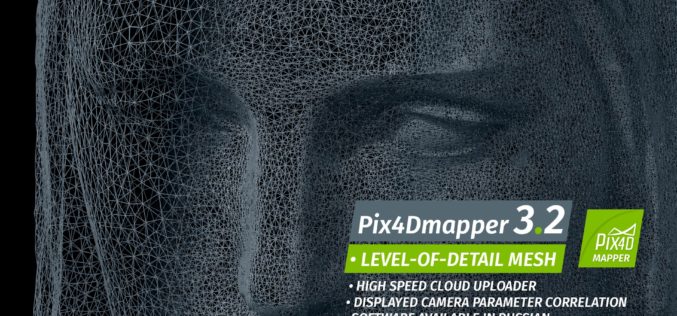
Pix4Dmapper 3.2 Now Generates Tiled Level-of-Detail (LoD) Mesh
May 2, 2017 – Today, we are happy to announce our Pix4Dmapper Desktop 3.2 release. The new version has great advancement in stability and usability – Upload desktop projects to cloud
Georeferenced Video, an Alternative to Aerial Photogrammetry
Contributed By:- According to the Texas Comptroller, the state of Texas spends nearly $6 million per year on public infrastructure, including highways and other repairs and maintenance activities. Local spending
Centrik Collaborates with AviComply to Support RPAS Operators Across South Africa
Centrik, the management system for Remotely Piloted Aircraft Systems (RPAS) is set to dramatically simplify RPAS compliance and operational management in South Africa through a new strategic alliance with AviComply.
East View Geospatial Announces Training Data Library for Geospatial Machine Learning
MINNETONKA, Minnesota, USA, 24 April 2017 – East View Geospatial (EVG), a provider of content-rich cartographic products, is building a library of highly accurate geospatial training data for use in
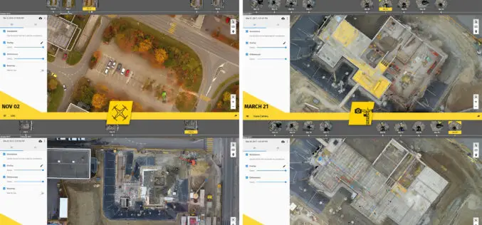
6 Major Construction Companies Adopt New Bim Monitoring Solution
Construction professionals understand that daily visualization of a job site helps minimize construction delays, prevent clashes between as-built and as design, eliminate the need for rework, facilitate stakeholder communication and
Comparable Maps, Anytime, Thanks to Pix4D and Sequoia Sunshine Sensor
Consistent Index Maps When you are a service provider with high client expectations, you need to be able to obtain quality results on a regular basis. When it comes to
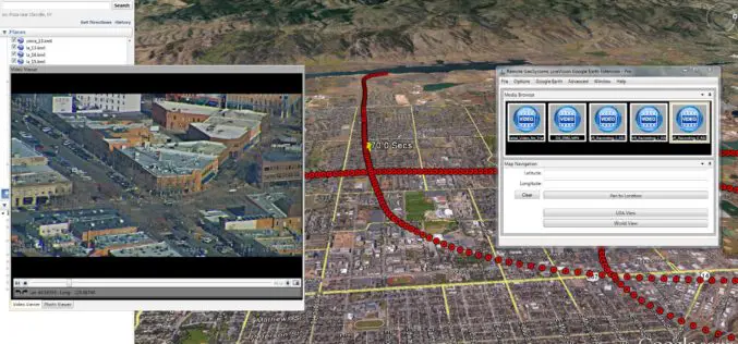
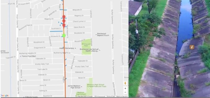
Remote GeoSystems Launches LineVision Google Earth Extension for Project Reporting with Geotagged Videos & Photos
Remote GeoSystems Releases All-New LineVision Google Earth Extension for Geotagged Video Playback, Analysis, Collaboration and Reporting Using Google Earth & Other GIS FORT COLLINS, Colorado – Remote GeoSystems, Inc. is

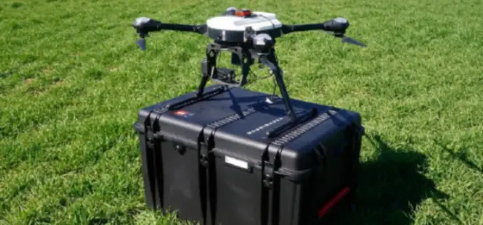
SimActive and Tianlifa Launch Integrated UAV Solution
Montreal, Canada, March 21st, 2017 – SimActive Inc., a world-leading developer of photogrammetry software, is pleased to announce a fully-integrated solution with Tianlifa, a major firm in the Asian surveying
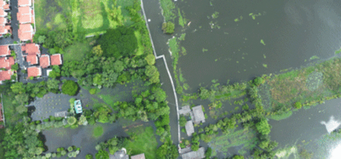
GIS & Decision Support Scenarios to Mitigate the Impact of Urban Flooding
A short spell of rain is enough to create chaos on roads in most urban areas in cities. Assurances by local authorities about preparedness to meet exigencies arising

OGC Seeks Public Comment on proposed Unmanned Systems Domain Working Group
The Open Geospatial Consortium (OGC®) seeks comments on the draft charter of a proposed Unmanned Systems Domin Working Group (UXS DWG). The proposed DWG will provide an open forum for
