
Tag "UAV"

INTERGEO Offers New Showcase For UAS Exhibitors
Integrated “interaerial SOLUTIONS” platform and partnership with “UAV DACH” association unveiled Stuttgart / Karlsruhe – INTERGEO’s integrated “interaerial SOLUTIONS” platform is a response to the rapid development in data acquisition,

Webinar: Generating Point Clouds with SimActive Correlator3D Version 6.1
Generating Point Clouds with SimActive Correlator3D Version 6.1 Wednesday, April 15, 2015 10:00 pm (Eastern Daylight Time) Correlator3D Version 6 introduced a revolutionary new interface for streamlined image processing of
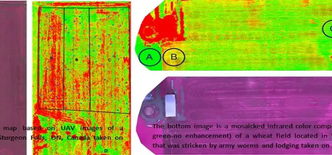
Applications of Low Altitude Remote Sensing in Agriculture
In a study by Chunhua Zhang et. al., on “Applications of Low Altitude Remote Sensing in Agriculture upon Farmers’ Requests– A Case Study in Northeastern Ontario, Canada” reveals the importance
Optech Presenting the Latest Mapping Solutions for Geosciences at EGU 2015
April 8, 2015 — Optech is pleased to announce that it will attend the 2015 European Geosciences Union (EGU) General Assembly in Vienna, Austria on April 12-17 to discuss the
3D Robotics (3DR) Announces DroneKit SDK and API for Developing Drone Apps
3D Robotics (3DR), North America’s largest consumer drone manufacturer, has released a new open software product called DroneKit – Software Development Kit (SDK) and Application Programming Interface (API) for drone app development. DroneKit allows developers

Smartone C from Smartplanes Reviewed By the Geo-Matching Community
The Geo-matching.com website features a selection of the most important geomatics equipment, including UAS for Mapping and 3D Modelling. At www.geo-matching.com, you can compare product specifications and read users’ reviews

Ph.D. in Remote Sensing of Vegetation at University of Wisconsin-Madison
The University of Wisconsin-Madison is one of the major research universities in the United States. It ranks 2nd in research expenditures among all U.S. universities and first among public universities.
The 5most viewedTotal Stations on Geo-matching.com
The Geo-matching.com website features a selection of the most important geomatics equipment, including Total Stations. At www.geo-matching.com you can compare product specifications and read users’ reviews before you buy. Geo-matching.com
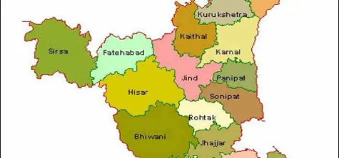
Haryana Government Sanctioned Rs 1.93 Crore Innovation Fund
In recent news, the Haryana government has sanctioned innovation funds of over Rs 1.93 crore to four districts namely Faridabad, Gurgaon, Karnal and Kurukshetra. Sumita Misra, principal secretary, science and
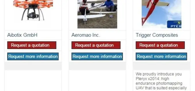
The 5most viewed UAVs for Mapping and 3D Modelling on Geo-matching.com
The Geo-matching.com website features a selection of the most important geomatics equipment, including UAS for Mapping and 3D Modelling. At www.geo-matching.com you can compare product specifications and read users’ reviews
