
Tag "Terrestrial LiDAR"
Automated Point Cloud Analysis for Forestry Mapping
Pointly has developed AI solution, that takes point clouds as input and outputs a shapefile with the location of tress for forestry mapping.
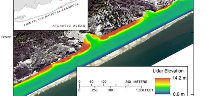
Terrestrial-based Lidar Beach Topography of Fire Island, New York
Abstract: The U.S. Geological Survey (USGS) St. Petersburg Coastal and Marine Science Center (SPCMSC) in Florida and the USGS Lower Mississippi-Gulf Water Science Center (LMG WSC) in Montgomery, Alabama, collaborated to
RIEGL USA Invites You to Join Terrestrial LiDAR Webinar
RIEGL USA Invites You to Our Terrestrial LiDAR Webinar 19 November 2015, 1:00 PM – 2:00 PM, Eastern Time In the fields of surveying, engineering, and construction, terrestrial LiDAR has become a

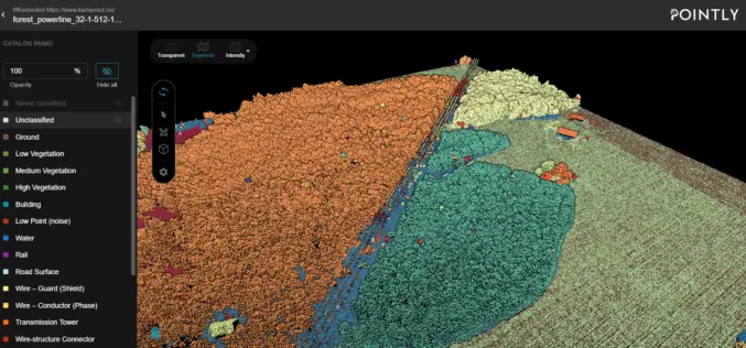
Updated Global Mapper LiDAR Module with Power Line Classification and Extraction
Blue Marble Geographics is pleased to announce the release of Global Mapper LiDAR module version 17.0. Released in conjunction with Version 17.0 of Global Mapper, the latest edition of the module includes
