
Tag "SuperGIS Desktop"
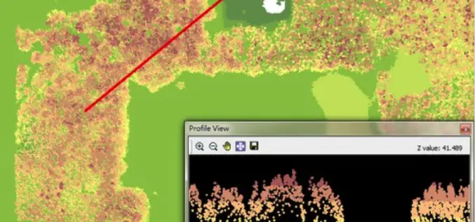
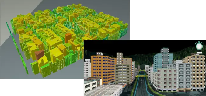
LiDAR, Point Cloud and SuperGIS Desktop 10
Have you ever thought of using LiDAR data through geographic information system to improve field tasks such as Forestry Management, Disaster Prevention, Coastal Change Management, and Contamination Simulation and so
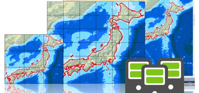
SuperGIS Desktop 3.3 Updated with 3D Analyst and Better Maptile Productivity
SuperGIS Desktop 3.3 is now released for GIS users around the world. With the latest SuperGIS Desktop 3.3, Cache Generator is dramatically improved, supporting multiple machine workflows and providing a consummate

SuperGIS Webinar: Smart Industrial Hazard Management with GIS
Smart Industrial Hazard Management with GIS To avoid chemical accident causes fatal damage of public lives, emergency dispatchers need various resources to plan prevention and response in advanced. Join SuperGIS
Brand New SuperGIS Desktop 3.3, Now Released for Worldwide Users!
SuperGIS Desktop 3.3, the powerful GIS software developed by Supergeo, is officially released! The latest version enhances map drawing, geodatabase, cache generator and data processing functions. By using SuperGIS Desktop

SuperGeo Webinar: Top 10 Features SuperGIS Desktop
SuperGeo Webinar: 10 Most Useful Features of SuperGIS Desktop 5th February, 11:00 AM – 11:30 AM (India Standard Time) Are you looking for powerful and comprehensive GIS solutions? Something that may

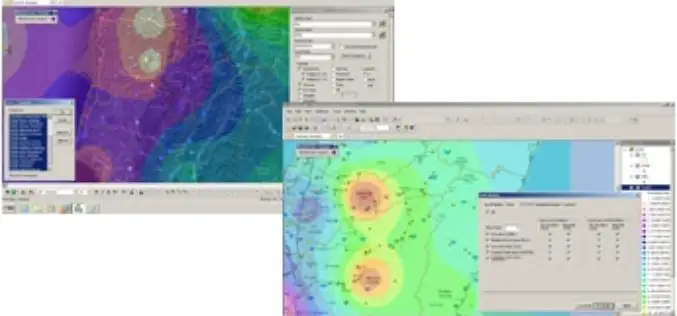
SuperGIS Helps National Research Council of Italy to Analyze Earth System
Supergeo Technologies, the global leading GIS software and solution provider, announced that Institute of Geosciences and Earth Resources, National Research Council of Italy (CNR) utilizes SuperSurv and SuperGIS Desktop to
Tag at Hot Tourist Spots with GIS
Tourism management is highly relevant with locations, so GIS is useful to find out better solutions. However, traditional research consumes a lot of time on data collecting, and is limited
SuperGIS Desktop Assists SME in USA in Conducting Restoration Projects
Supergeo Technologies, the global leading GIS software and solution provider, announces that SuperGIS Desktop 3.2 supports Bitterroot Technical Associates, USA, to guide restoration programs for environmental management. SuperGIS Desktop 3.2
Philippine National Irrigation Systems Upgrades Parcel Maps by SuperGIS Desktop
Supergeo Technologies, a leading global provider of GIS software and solutions, announces that Philippines National Irrigation Systems (NIA) upgrades the country’s parcellary maps through SuperGIS Desktop to elevate the efficiency
Hong Kong Polytechnic University Empowers GIS Analyst with SuperGIS Desktop
Supergeo Technologies, the leading global provider of GIS software and solutions, announces that Hong Kong Polytechnic University (HKPU) selects SuperGIS Desktop through Star Vision, Supergeo certified reseller, to educate the
