
Tag "satellite"
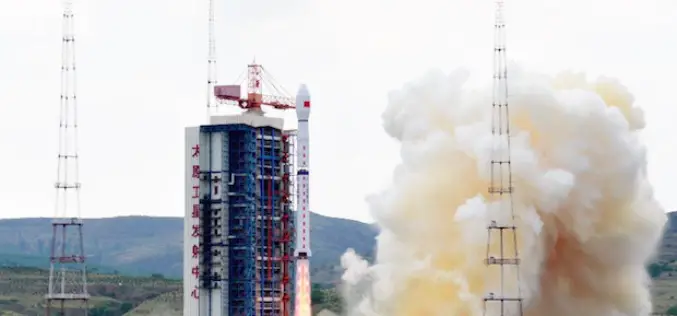
China Launches Gaofen 8 Earth Observation Satellite
In recent news, China has successfully launched the Gaofen 8, a high resolution optical remote sensing satellite into a scheduled near-circular orbit with an average altitude of around 473 kilometers, or

Belarus and Russia Jointly to Develop Remote Sensing Satellite
As reported in BELTA News Agency, in a statement made by Chairman of the Presidium of the National Academy of Sciences of Belarus (NASB) Vladimir Gusakov as he met with
Russia to Launch Constellation of Earth Observation Satellite
As a part of major project, the Russian Federal Space Agency Roscosmos is planning to expand the number of earth observation satellites. The project also includes setting up of a

Delhi Govt to Use Remote Sensing Technology to Check Illegal Construction
New Delhi – May 20, 2015: Delhi Government on Wednesday said it will use remote sensing satellite technology to check and map unauthorised constructions and encroachments in the city and
Taiwan has Indigenously Built its First Optical Remote Sensing Instrument for FORMOSAT-5 Satellite
In recent news from Focus Taiwan, the National Applied Research Laboratories (NARLabs) of Taiwan, announced that country has indigenously built the first optical remote sensing instrument (RSI) in Taiwan that

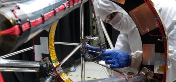
Satellites – A Reliable Source for Earth Observation
ISRSE – 750 experts meet in Berlin to discuss trends and challenges in remote sensing How is the ozone layer changing? What is the distribution of trace gases in Earth’s
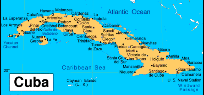
Cuba Promotes Use of Satellite Remote Scanning and Detecting
Havana, May 7 (Prensa Latina) Cuba shows a sample called “A Look to the Outer Space”, which promotes the use of satellite remote scanning and detecting to be used for

DigitalGlobe Produces the World’s First Complete and Consistent High Resolution Satellite Imagery Base Map of Africa
LONDON–(BUSINESS WIRE)–Apr. 28, 2015– DigitalGlobe, Inc. (NYSE: DGI), a leading global provider of high-resolution earth imagery and geospatial solutions, today announced the general availability of its Basemap +Vivid product for
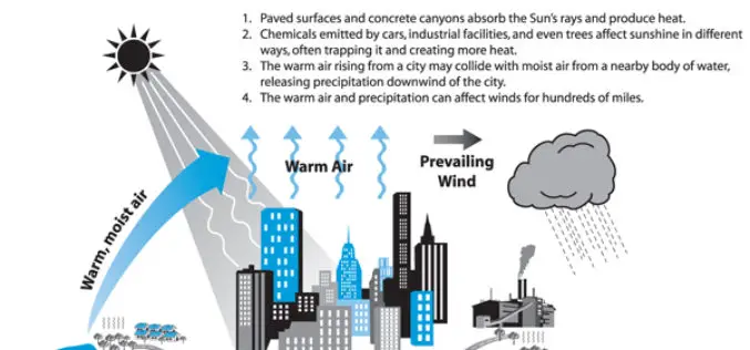
Analysis of the Urban Heat Island Effect in Shijiazhuang, China Using Satellite and Airborne Data
Analysis of the Urban Heat Island Effect in Shijiazhuang, China Using Satellite and Airborne Data – Kai Liu, Hongbo Su, Lifu Zhang, Hang Yang, Renhua Zhang and Xueke Li Abstract: The urban heat island (UHI)
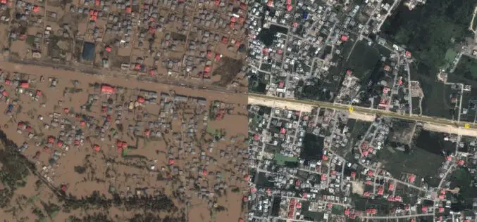
Kashmir Floods Monitored By Latest Satellite Technology
Union Minister Jitendra Singh said that Kashmir floods are being constantly monitored by latest satellite technology at the National Remote Sensing Centre. “Kashmir floods are being constantly monitored by latest

