
Tag "Satellite imagery"

Celebrate Google Earth 10 Birthday with Two New Features
Happy Birthday, Google Earth! It has been a full decade to the launch of Google Earth, has provided the capability to visualize and analyze geographic data for various scientific applications

Hexagon Geospatial and BlackSky Global Establish Partnership
Hexagon Geospatial is pleased to announce it has partnered with BlackSky Global in a new content-sharing program that will bring together both satellite imagery and software for use in the
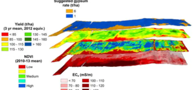
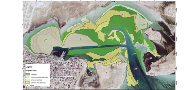
Crop and Soil Mapping Boosts Potential for Increased Yields
A research project started at 2008 by Sugar Research Australia (SRA) with additional support from QDAFF, the collaborative project brings together research expertise from CSIRO, the University of Southern Queensland’s
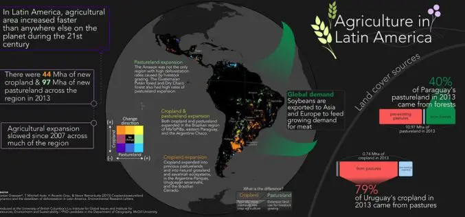
Remote Sensing to Study Dynamics of Cropland in Latin America
In a study, “Cropland/pastureland dynamics and the slowdown of deforestation in Latin America,” published in Environmental Research Letters by Jordan Graesser and et. al., brings out some interesting facts about

DigitalGlobe Produces the World’s First Complete and Consistent High Resolution Satellite Imagery Base Map of Africa
LONDON–(BUSINESS WIRE)–Apr. 28, 2015– DigitalGlobe, Inc. (NYSE: DGI), a leading global provider of high-resolution earth imagery and geospatial solutions, today announced the general availability of its Basemap +Vivid product for
DigitalGlobe Announces Availability of 30 cm Satellite Imagery to All Customers
Higher Resolution Satellite Imagery Now a Highly Competitive Alternative to Aerial Imagery for Global Applications LONGMONT, Colo.–(BUSINESS WIRE)–Feb. 25, 2015– DigitalGlobe, Inc. (NYSE: DGI), a leading global provider of high-resolution earth

Exelis Webinar: Increase Agricultural Efficiencies Using Satellite Imagery
Exelis Webinar on Increase Agricultural Efficiencies Using Satellite Imagery February 5, 2015 As anyone living in a major drought region will tell you, water has become the new gold. Properly conserving and
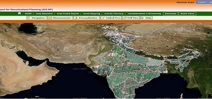
ISRO Empowering Panchayati Raj Institutions using Bhuvan Panchayats
Bhuvan Panchayats Portal plays an important role to disseminate the deliverables of the project including High Resolution Satellite Imagery and Resource Maps at 1: 10,000 scale, to the three levels
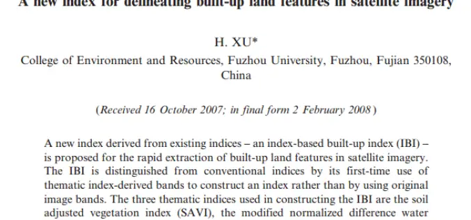
A New Index for Delineating Built-up Land Features in Satellite Imagery
A New Index for Delineating Built-up Land Features in Satellite Imagery H. XU College of Environment and resources, Fuzhou University, Fuzhou, Fujian 350108, China Download full paper in PDF
Qatar University Begins Digital Archiving
In a recent news by Gulf Times, Remote Sensing and Geographic Information Systems (GIS) Unit in the Environmental Studies Centre (ESC) at Qatar University has initiated the course of action to digitally
