
Tag "RADARSAT-2"
MDA to Provide RADARSAT-2 Information to Meet Critical and Complex Challenges for Land and Maritime Monitoring
March 26, 2018 – Richmond, BC – MDA, a Maxar Technologies company (formerly MacDonald, Dettwiler and Associates Ltd.), (NYSE: MAXR; TSX: MAXR), announced today it has recently signed multiple geospatial-related
PCI Geomatics Releases Geomatica 2017, Service Pack 1
MARKHAM, Ontario, Canada, September 12, 2017 – PCI Geomatics, a world leading developer of remote sensing and photogrammetric software and systems, announced today the release of Service Pack 1 for
DigitalGlobe Makes MDA’s RADARSAT-2 Data Available on the Geospatial Big Data platform
WESTMINSTER, Colo.–(BUSINESS WIRE)–Jun. 5, 2017– DigitalGlobe, Inc. (NYSE: DGI), the global leader in Earth imagery and information about our changing planet, today announced an agreement with MacDonald, Dettwiler and Associates
MDA to provide US National Oceanic and Atmospheric Administration (NOAA) with RADARSAT-2 Information for Ice Monitoring
Vancouver, BC – MacDonald, Dettwiler and Associates Ltd. (“MDA” or the “Company”) (TSX: MDA), a global communications and information company, today announced that it has signed a contract with the
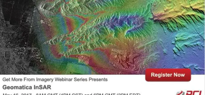
PCI Geomatics Webinar Series: Geomatica InSAR
PCI Geomatics Webinar: Geomatica Object Analyst May 16, 2017 | 8AM GMT / 4PM CST & 6PM GMT / 2PM EDT In this webinar, we’ll take a deep dive into the new InSAR
MDA to Provide RADARSAT-2 Information for Maritime Surveillance
Vancouver, BC – MacDonald, Dettwiler and Associates Ltd. (“MDA” or the “Company”) (TSX: MDA), a global communications and information company, today announced that it has signed three contracts with a
EMSA Expands Use of RADARSAT-2 Information for Maritime Applications
Richmond, BC – MacDonald, Dettwiler and Associates Ltd. (“MDA” or the “Company”) (TSX: MDA), a global communications and information company, has recently (July 13, 2016) announced that it has signed
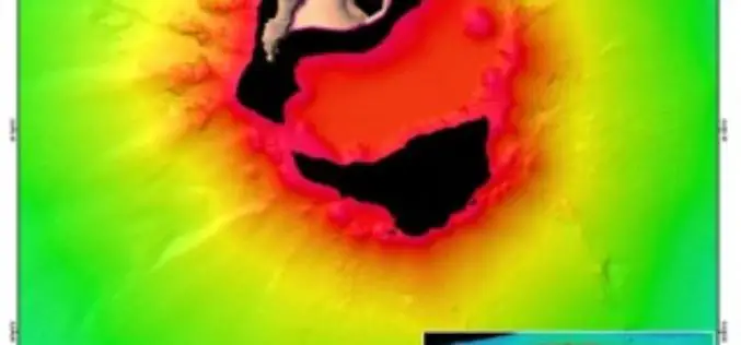
Scientists Explore Earth’s Newest Land Using Advanced, High-Resolution 3D Mapping
SUVA, FIJI – Research vessel (R/V) Falkor will return to port today after 28 days at sea conducting pioneering studies including mapping the Earth’s newest island landscape in the Kingdom

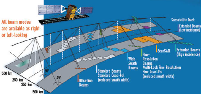
TerraSAR-X and RADARSAT-2 to Improve Monitoring Over North Canadian Region
– The German Aerospace Center (DLR) has awarded Airbus Defence and Space with two research projects to enhance Emergency Preparedness and Safety of Operations in collaboration with Canadian partners –
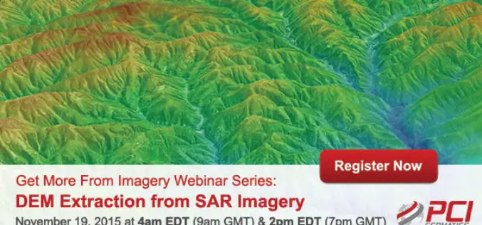
Webinar Series: DEM Extraction from SAR Imagery
Get More From Imagery Webinar Series: DEM Extraction from SAR Imagery Nov. 19, 2015 at 4am EDT (9am GMT) | Nov. 19, 2015 at 2pm EDT (7pm GMT) PCI Geomatics is the
